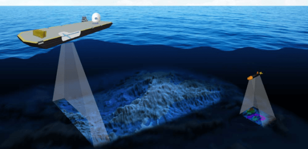
Mapping of the ocean floor may expand under an order signed by President Donald Trump on in November, 2019 to create a federal plan to explore U.S. coastal waters. The announcement…comes amid growing international interest in charting the sea floor as unmanned aquatic drones and other new technologies promise to make the work cheaper and faster. The maps, also created by ship-towed sonar arrays, are crucial to understanding basic ocean dynamics, finding biological hot spots, and surveying mineral, oil, and gas deposits.
But much of the ocean floor remains unmapped; an international campaign called Seabed 2030 aims to map all of it in detail by 2030. Such maps cover just 40% of the 11.6 million square kilometers in the U.S. exclusive economic zone, which extends 320 kilometers from the coasts of all U.S. states and territories—an area larger than the total U.S. land mass. Today, those maps are a hodgepodge drawn from government, industry, and academic research, says Vicki Ferrini, a marine geophysicist at Columbia University’s Lamont-Doherty Earth Observatory in Palisades, New York. The federal plan, she says, could be a “game changer.”
Excerpts from United States to Survey Nearby Sea Floor, Science, Nov. 29, 2019, at 6469
