Tag Archives: microsatellites

Whoever Controls Space Controls Everything

The U.S. military wants allies to train and plan together for space operations, in the same way that they already do in ground, air and naval combat, Gen. Chance Saltzman, chief of space operations, said in an interview in July 2023. The move comes amid concerns about China and Russia’s ability to disrupt the West’s satellites and new technology the two countries have developed, including satellites that can grab others

Russia, for instance, has conducted operations to disrupt Ukraine’s space-enabled communications. Saltzman said that Russia has been sending satellites “irresponsibly close” to those of other nations to shadow them. Moscow has “nesting doll” satellites, which can release an object that can be used to attack other objects in space, while China has tested robotic arms that can be used to grab other satellites. Both countries have demonstrated missiles that can destroy orbiting satellites…

“Quantity is a quality in itself,” he said, using an expression often employed in the military. For example, the satellites of a large coalition would be harder to target than those of one nation, he added.

Excerpt from Alistair MacDonald, U.S. Pushes Military Cooperation in Space, WSJ, July 18, 2023

Space Control in the Future of War: Ukraine

The Starlink constellation of SpaceX currently consists of 3,335 active satellites and has become an integral part of Ukraine’s military and civil response to Russia’s invasion…Appropriately enough, the story started with a tweet, one sent by Mykhailo Fedorov, Ukraine’s minister of digital transformation, two days after the invasion:

@elonmusk, while you try to colonize Mars —Russia try to occupy Ukraine! While your rockets successfully land from space—Russian rockets attack Ukrainian civil people! We ask you to provide Ukraine with Starlink stations and to address sane Russians to stand.

Mr Musk replied to him within hours, saying that the Starlink service had been turned on over Ukraine and that the hardware would follow. Within days lorries full of the pizza-sized flat dishes used to access the satellites began to arrive in Ukraine.

By May 2022 around 150,000 people were using the system every day. The government quickly grew to rely on it for various communication needs, including, on occasion, the transmission of the nightly broadcast by Volodymyr Zelensky, Ukraine’s president. Because the dishes and their associated terminals are easily portable and can be rigged to run off a car battery, they are ideal for use in a country where the electricity and communication networks are regularly pounded by Russian missiles. When Kherson was liberated in November 2022 Starlink allowed phone and internet services to resume within days.

Crucially, Starlink has become the linchpin of what military types call C4ISR (command, control, communications, computers, intelligence, surveillance and reconnaissance). Armies have long relied on satellite links for such things…But Most satellite communications make use of big satellites which orbit up at 36,000km. Perched at such a height a satellite seems to sit still in the sky, and that vantage allows it to serve users spread across very large areas. But even if such a satellite is big, the amount of bandwidth it can allocate to each user is often quite limited.

The orbits used by Starlink’s much smaller satellites are far lower: around 550km. This means that the time between a given satellite rising above the horizon and setting again is just minutes. To make sure coverage is continuous thus requires a great many satellites, which is a hassle. But because each satellite is serving only a small area the bandwidth per user can be high. And the system’s latency—the time taken for signals to get up to a satellite and back down to Earth—is much lower than for high-flying satellites. 

Franz-Stefan Gady, of the International Institute for Strategic Studies, a think-tank, recently visited the Ukrainian front lines and saw an example of what cheap, ubiquitous connectivity makes possible: a sort of Uber for howitzers. .. “Ukrainian military operations are hugely dependent on having access to the internet,” says Mr Gady, “so Starlink is a most critical capability.” A Ukrainian soldier puts it more starkly. “Starlink is our oxygen,” he says. Were it to disappear “Our army would collapse into chaos.”…

Starlink signals are strong compared with those from higher flying satellites, which makes jamming them harder. And the way that the dishes use sophisticated electronics to create narrow, tightly focused beams that follow satellites through the sky like invisible searchlights provides further resistance to interference…

If its signals cannot be jammed, the system itself could be attacked instead….Cyber-attacks like the one aimed at Ukraine’s legacy satellite system on February 24, 2022 are one possibility. So far, though, similar sallies against Starlink appear to have been ineffective, in part thanks to SpaceX’s ability to quickly update the system’s software. Dave Tremper, director of electronic warfare for the Office of the Secretary of Defense, has said the speed of the software response he witnessed to one attack was “eye-watering”.

And then there are the satellites themselves. America, China, India and Russia have missiles that can shoot satellites out of the sky. Again, though, using them would seem a severe escalation. It would also be a lot less useful against a constellation like Starlink than against older systems. Knocking out a single Starlink would achieve more or less nothing. If you want to damage the space-based bit of the system, you need to get rid of lots of them…

In 2020 China filed documents with the International Telecommunication Union, a UN body, for a 13,000-satellite constellation of its own.

Excerpts from The Satellites that Saved Ukraine, Economist, Jan. 7, 2023

Stargazing as a Right and Colonization of Skies

Do people have a right to an unobstructed view of the heavens? For most of human history, such a question would have been considered nonsensical—but with the recent rise of satellite mega constellations, it’s now being asked again and again. Mega constellations are vast groups of spacecraft, numbering in the thousands, that could spark a multitrillion-dollar orbital industry and transform global connectivity and commerce. But the rise of mega constellations also threatens to clutter the night sky, disrupt the work of some astronomers and create space debris that harms people on Earth and in space alike. The mega constellation era began in May 2019, when Elon Musk’s firm SpaceX launched the first 60 satellites in its Starlink constellation… Today the constellation’s numbers have swelled to more than 3,000 and account for fully half of all active satellites in space.

Ramon Ryan has argued in the in the Vanderbilt Journal of Entertainment and Technology Law that the regulatory approval of these satellites by the U.S. Federal Communications Commission (FCC) may breach environmental law as part of the U.S. National Environmental Policy Act (NEPA) enacted in 1970. Specifically, he argued that the natural aesthetic of the night sky and the profession of astronomy may be protected under NEPA—but that the FCC has so far sidestepped NEPA’s oversight , thanks to a “categorical exclusion” the agency was granted in 1986 (when it simply wasn’t licensing that many satellites)….  

In November 2022, the US General Accounting Office (GAO) published a report that suggest that the FCC should revisit its categorical exclusion from NEPA and consider whether it should update its procedures in light of the rise of mega constellations. “We think they need to revisit [the categorical exclusion] because the situation is so different than it was in 1986,” says Andrew Von Ah, a director at the GAO…The White House Council on Environmental Quality (CEQ) recommends that agencies “revisit things like categorical exclusions once every seven years,” Von Ah says. But the FCC “hasn’t really done that since 1986.”

According to the report’s recommendations, the FCC should review whether mega constellations affect the environment…The findings showed there were concerns in a number of areas, not just the brightness of the satellites but also the collision risk they pose in space and the possible creation of space junk, the interference to radio astronomy caused by satellite radio transmissions and even the potential for satellites reentering the atmosphere to affect Earth’s climate or harm humans on the ground. ..

The day after the GAO report’s release, the FCC  announced the creation of a new bureau for its space activities, which will help the agency handle the applications for 64,000 new satellites it is presently considering…

Excerpts from  Jonathan O’Callaghan Satellite Constellations Could Harm the Environment, New Watchdog Report Says, Scientific American, November 24, 2022

The Right to Know from Space

Rebuilding an entire planet’s energy system is a big job…The most basic problem is knowing what, exactly, you are trying to rebuild. Academic-research groups, think-tanks, charities and other concerned organizations try to keep track of the world’s wind turbines, solar-power plants, fossil-fueled power stations, cement factories and so on. To this end, they rely heavily on data from national governments and big companies, but these are often incomplete. The most comprehensive database covering American solar-power installations, for instance, is thought to miss around a fifth of the photovoltaic panels actually installed on the ground.

In a paper published in Nature, a team of researchers demonstrate another way to keep tabs on the green-energy revolution. Dr Kruitwagen and his colleagues have put together an inventory of almost 69,000 big solar-power stations (defined as those with a rated capacity of 10kw of electricity or more) all over the world—more than four times as many as were previously listed in public databases. This new inventory includes their locations, the date they entered service and a rough estimate of their generating capacity…

Pictures came from two sets of satellites, Sentinel-2 and SPOT, run by the European Space Agency and Airbus respectively. These peer down on the world, recording visible light and also the infrared and ultraviolet parts of the spectrum. The images amounted to around 550 terabytes of data, spanning the period between 2016 and 2018. That is enough to fill more than a hundred desktop hard drives. Sifting through this many pictures by eye would have been impractical. That is where the second technological trend comes in. Dr Kruitwagen and his colleagues trained a machine-learning system to spot the solar panels for them.

More generally, Dr Kruitwagen hopes that his eye-in-the-sky approach—which, despite the planetary scale of the project, cost only around $15,000 in cloud-computing time—could presage more accurate estimates of other bits of climate-related infrastructure, such as fossil-fuel power stations, cement plants and terminals for ships carrying liquefied natural gas. The eventual result could be the assembly of a publicly available, computer-generated inventory of every significant bit of energy infrastructure on Earth. Quite apart from such a model’s commercial and academic value, he says, an informed public would be one better able to hold politicians’ feet to the fire. 

Excerpt from Solar-cell census: An accurate tally of the world’s solar-power stations, Economist, Oct. 30, 2021

A Lethal Combination: Pentagon and NASA

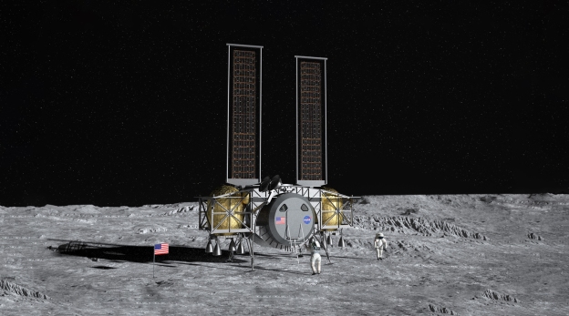
U.S. government and aerospace-industry officials are removing decades-old barriers between civilian and military space projects, in response to escalating foreign threats beyond the atmosphere. The Pentagon and the National Aeronautics and Space Administration (NASA) are joining forces to tackle efforts such as exploring the region around the moon and extending the life of satellites. Many details are still developing or remain classified.  Driving the changes are actions by Moscow and Beijing to challenge American space interests with antisatellite weapons, jamming capabilities and other potentially hostile technology. Eventually, according to government and industry officials briefed on the matter, civil-military cooperation is expected to extend to defending planned NASA bases on the lunar surface, as well as protecting U.S. commercial operations envisioned to extract water or minerals there…

Large and small contractors are maneuvering to take advantage of opportunities to merge military and nonmilitary technologies. They include established military suppliers that already have a foot in both camps, such as Northrop Grumman,  the Dynetics unit of Leidos Holdings, and Elon Musk’s Space Exploration Technologies Corp. Smaller companies such as Maxar Technologies Holdings,  closely held robotic-lander maker Astrobotic Technology, and small-satellite producer Blue Canyon Technologies, recently acquired by Raytheon Technologies, also seek to diversify in the same way…

The U.S. astronaut corps always has included many military officers, some previous NASA scientists quietly shared data with military counterparts and NASA’s now-retired Space Shuttle fleet was supposed to launch Pentagon satellites. But today, veteran industry and government experts describe the cooperation as much more extensive, covering burgeoning capabilities such as repairing and repurposing satellites in orbit, or moving them around with nuclear propulsion. Intelligence agencies are more involved than ever in leveraging civilian technology, including artificial intelligence, robotic capabilities and production know-how.

Excerpt from Pentagon, NASA Knock Down Barriers Impeding Joint Space Projects, WSJ, Feb. 1, 2021

Hunting Down Polluters from Space

When scanning for emissions from a mud volcano in western Turkmenistan in January 2019, a satellite called Claire came across a large plume of methane drifting across the landscape. … The company operating the satellite, GHGSAT passed details via diplomats to officials in Turkmenistan, and after a few months the leaks stopped. This largely unknown incident illustrates two things: that satellites can play an important role in spotting leaks of greenhouse gases and, rather worryingly, that the extent of such leaks is often greatly underestimated. The data from Claire suggested the leak in Turkmenistan had been a big one…142,000 tonnes of methane. This made the Turkmenistani leak far bigger than the 97,000 tonnes of methane discharged over four months by a notorious blowout at a natural-gas storage facility in Aliso Canyon, California, in 2015, which is reckoned to have been the worst natural-gas leak yet recorded in America. There have been other big leaks, too…

The reason for concern is that although methane, the main constituent of natural gas, does not linger in the atmosphere for anywhere near as long as carbon dioxide does, it is a far more potent heat-trapping agent. About a quarter of man-made global warming is thought to be caused by methane. And between a fifth and a third of the methane involved is contributed by the oil and gas industry. Methane can be detected spectroscopically. Like other gases, it absorbs light at characteristic frequencies. With a spectrometer mounted on a satellite it is possible to analyse light reflected from Earth for signs of the gas. As with the satellites that carry them, spectrometers come in many shapes and sizes. Tropomi can also detect the spectral signs of other polluting gases, such as nitrogen dioxide, sulphur dioxide and carbon monoxide.

Other methane-hunting satellites are coming. These include one due for launch in 2022 by Methanesat, an affiliate of the Environmental Defence Fund, an American non-profit organisation. The 350kg satellite will cost $88m to build and put into orbit. It will scan an area of land 200km wide with a resolution of 1km by 1km. According to Methanesat, it will be the most sensitive to emission levels yet, being able to detect methane concentrations as low as two parts-per-billion. Data collected by the satellite will be publicly available.

Excerpts from The Methane Hunters, Economist, Feb. 1 2020

Poker and Blackjack: How to Make War in Space

In March 2018, India became only the fourth country in the world—after Russia, the US, and China—to successfully destroy a satellite in orbit. Mission Shakti, as it was called, was a demonstration of a direct-ascent anti-satellite weapon (ASAT)—or in plain English, a missile launched from the ground. Typically this type of ASAT has a “kill vehicle,” essentially a chunk of metal with its own guidance system, mounted on top of a ballistic missile. Shortly after the missile leaves the atmosphere, the kill vehicle detaches from it and makes small course corrections as it approaches the target. No explosives are needed; at orbital speeds, kinetic energy does the damage…. China’s own first successful ASAT test was in 2007….

But going to war in space… doesn’t necessarily mean blowing up satellites. Less aggressive methods typically involve cyberattacks to interfere with the data flows between satellites and the ground stations.  Satellites are, after all, computers that happen to be in space, so they are vulnerable to attacks that disable or hijack them, just like their terrestrial peers.

For example, in 2008, a cyberattack on a ground station in Norway let someone cause 12 minutes of interference with NASA’s Landsat satellites. Later that year, hackers gained access to NASA’s Terra Earth observation satellite and did everything but issue commands. It’s not clear if they could have done so but chose not to. Nor is it clear who was behind the attack, although some commentators at the time pointed the finger at China. Experts warn that hackers could shut off a satellite’s communications, rendering it useless. Or they could permanently damage it by burning off all its propellant or pointing its imaging sensor at the sun to burn it out.

Another common mode of attack is to jam or spoof satellite signals. There is nothing fancy about this: it’s easier than hacking, and all the gear required is commercially available.  Jammers, often mounted on the back of trucks, operate at the same frequency as GPS or other satellite communication systems to block their signals. …There are strong suspicions that Russia has been jamming GPS signals during NATO exercises in Norway and Finland, and using similar tactics in other conflicts. “Russia is absolutely attacking space systems using jammers throughout the Ukraine,” says Weeden. Jamming is hard to distinguish from unintentional interference, making attribution difficult (the US military regularly jams its own communications satellites by accident). A recent report from the US Defense Intelligence Agency (DIA) claims that China is now developing jammers that can target a wide range of frequencies, including military communication bands. North Korea is believed to have bought jammers from Russia, and insurgent groups in Iraq and Afghanistan have been known to use them too.

Spoofing, meanwhile, puts out a fake signal that tricks GPS or other satellite receivers on the ground…. Russia also seems to use spoofing as a way of protecting critical infrastructure,,,.As well as being hard to pin on anyone, jamming and spoofing can sow doubt in an enemy’s mind about whether they can trust their own equipment when needed. The processes can also be switched off at any time, which makes attribution even harder.

The 2019 Defense Intelligence Agency (DIA) report suggests that China will have a ground-based laser that can destroy a satellite’s optical sensors in low Earth orbit as early as next year (and that will, by the mid-2020s, be capable of damaging the structure of the satellite). Generally, the intention with lasers is not to blast a satellite out of the sky but to overwhelm its image sensor so it can’t photograph sensitive locations. The damage can be temporary, unless the laser is powerful enough to make it permanent…In 2006, US officials claimed that China was aiming lasers at US imaging satellites passing over Chinese territory.

“It’s happening all the time at this low level,” says Harrison. “It’s more gray-zone aggression. Countries are pushing the limits of accepted behavior and challenging norms. They’re staying below the threshold of conflict.”..

The suspicion is that China is practicing for something known as a co-orbital attack, in which an object is sent into orbit near a target satellite, maneuvers itself into position, and then waits for an order. Such exercises could have less aggressive purposes—inspecting other satellites or repairing or disposing of them, perhaps. But co-orbiting might also be used to jam or snoop on enemy satellites’ data, or even to attack them physically….Russia, too, has been playing about in geostationary orbit. One of its satellites, Olymp-K, began moving about regularly, at one point getting in between two Intelsat commercial satellites. Another time, it got so close to a French-Italian military satellite that the French government called it an act of “espionage.” The US, similarly, has tested a number of small satellites that can maneuver around in space.

As the dominant player in space for decades, the US now has the most to lose. The DIA report points out that both China and Russia reorganized their militaries to give space warfare a far more central role. In response, the US military is starting to make satellites tougher to find and attack. For instance, the NTS-3, a new experimental GPS satellite scheduled for launch in 2022, will have programmable, steerable antennas that can broadcast at higher power to counter jamming. It’s designed to remain accurate even if it loses its connection with ground controllers, and to detect efforts to jam its signal.

Another solution is not just to make single satellites more resilient, but to use constellations in which any one satellite is not that important. That’s the thinking behind Blackjack, a new DARPA program to create a cheap network of military communications satellites in low Earth orbit.

Excerpts from Niall Firth How to fight a war in space (and get away with it), MIT Technology Review, June 26, 2019

The Space Rat Race

India, Japan and other space-faring countries are waking up to a harsh reality: Earth’s orbit is becoming a more dangerous place as the U.S., China and Russia compete for control of the final frontier…New Delhi is nervous because China has made no secret of its desire for influence in the Indian Ocean. China set up a naval base in Djibouti, a gateway to the ocean at the Horn of Africa. It secured a 99-year lease to the port of Hambantota in Sri Lanka. It is deeply involved in development projects in Maldives.

India has established itself as a player in the budget satellite business. It even put a probe into orbit around Mars in 2014, in a U.S.-assisted project that cost just $76 million. But it is scurrying to enhance its ability to monitor China’s activities, and the partnership with Japan is part of this.  Another sign that space is becoming a defense focus for India came on Dec. 19, when the country launched its third military communications satellite, the GSAT-7A. The satellite will connect with ground-based radar, bases and military aircraft, along with drone control networks.

China’s success in landing a craft on the far side of the moon on Jan. 3, 2019 came as a fresh reminder of its growing prowess. In late December, China also achieved global coverage with its BeiDou Navigation Satellite System. Only the U.S., Russia and the European Union had that capability.China aims to launch a Mars explorer in 2020 and complete its own Earth-orbiting space station around 2022.  In the back of Indian and Japanese officials’ minds is likely a stunning test China conducted in 2007. Beijing successfully destroyed one of its own weather satellites with a weapon, becoming only the third nation to pull off such a feat, after the Soviet Union and the U.S.

In December 2018, President Donald Trump ordered the Department of Defense to create a Space Command, widely seen as a precursor to a full-fledged Space Force.  There were 1,957 active satellites orbiting Earth as of Nov. 30, 2018 according to the Union of Concerned Scientists, a nonprofit U.S. advocacy group. America had the most by far, with 849, or 43% of the total. China was No. 2, with 284, followed by Russia with 152.  Japan and India had a combined 132 — 75 for the former and 57 for the latter.

Excerpts fromNUPUR SHAW India and Japan awaken to risks of superpower space race, Nikkei Asian Review, Jan. 8, 2019

Killing Machines: Tiny Spy Satellites

As long as we’ve been launching spy satellites into space, we’ve been trying to find ways to hide them from the enemy. Now, thanks to the small satellite revolution—and a growing amount of space junk—America has a new way to mask its spying in orbit…

The National Reconnaissance Office, the operator of many of the U.S.’s spy sats, refused to answer any questions about ways to hide small satellites in orbit.  In 2014, Russia launched a trio of communications satellites. Like any other launch, spent stages and space debris were left behind in space. Air Force Space Command dutifully catalogued them, including a nondescript piece of debris called Object 2014-28E.  Nondescript until it started to move around in space, that is. One thing about orbits; they are supposed to be predictable. When something moves in an unexpected way, the debris is not debris but a spacecraft. And this object was flying close to the spent stages, maneuvering to get closer.  This fueled speculation that the object could be a prototype kamikaze-style sat killer. Other less frantic speculation postulated that it could be used to examine other sats in orbit, either Russia’s or those operated by geopolitical foes. Either way, the lesson was learned…

Modern tracking radar is supposed to map space junk better than ever before. But small spy satellites that will hide in the cloud of space debris may go undetected, even by the most sophisticated new radar or Earth-based electronic signals snooping.

Excerpts from Joe Pappalardo, Space Junk Could Provide a Perfect Hiding Spot for Tiny Spy Satellites, Popular Mechanics, Nov. 30, 2018

The First to Shoot…from Space

North Korea’s preparations to launch a more advanced reconnaissance satellite with a high-resolution scanning capability threaten to push Asia’s space race deeper into the military theater.  The Kwangmyongsong-5 Earth-exploration satellite, likely to be packaged with a separate communications satellite, will technically allow North Korea to transmit data down to the ground for the first time, thus offering real-time intelligence for potential ballistic-missile strikes.

This is well short of the technological capacity needed to deploy orbital weapon systems, but will cause some unease among Asian power-brokers China, Japan and India as they pour money into the last strategic frontier of outer space.  Space programs in Asia have largely been driven by competition for the US$300 billion global commercial transponders market, which is expected to double by 2030 if demand holds.

A shift toward miniature satellites of less than 20 kilograms, mostly used by governments and smaller companies, has drawn nations as diverse as Singapore, Pakistan, Vietnam and South Korea into a field led by Japan and China, with India a more recent player.

Japan placed two satellites in different orbits for the first time on December 2017, displaying a technical edge aimed at reducing launch costs for commercial clients. India announced this week that it had successfully tested a GSLV Mark III rocket that can lift a 4-ton satellite into orbit. In 2017, it managed to launch 104 satellites of varying sizes in just one operation. China has loftier ambitions, including a lunar landing some time in 2018, after sending a roving module down a steep crater on the moon in 2013. About 40 Chinese launches are likely in 2018, mainly to boost communications.  India and Japan are both locked in undeclared space races with China that go well beyond commercial rivalries and have muddied the debate over North Korea’s shadowy aims….

“Militarization” refers to any systems that enhance the capability of forces in a conventional setting, such as intelligence, communications and surveillance. “Weaponization” is the physical deployment of weapons in outer space or in a ground mode where they can be used to attack and destroy targets in orbit.  The United Nations Treaty on Outer Space prohibits the deployment of weapons of mass destruction in space, but the US has blocked efforts to ban space weapons outright. In 2007, Washington said it would “preserve its rights, capabilities, and freedom of action in space.”

Excerpts from  ALAN BOYD,  Asia’s Space Race Gathers Pace, Asia Times, Jan. 6, 2018

The Quiet Revolution in Space

National security critically depends on space, and the Defense Advanced Research Projects Agency (DARPA) is focused today on creating the capabilities needed to help make that environment a real-time operational domain, DARPA Director Dr. Arati Prabhakar…

“The questions we ask ourselves at DARPA about the space domain … is what would it take to make the space domain robust for everything that we need militarily and for intelligence, and what would it take to make space a real-time operational domain, which it’s not at all today,” the director said, noting that many other nation-states now are active in orbit and space is a domain where conflict is becoming a real possibility.

Through a national security lens, she added, nothing needed from an intelligence or military perspective can be done effectively without access to space. Something as simple as navigation completely depends on GPS in nearly every part of the world and in every operating regime.

In an era of declining budgets and adversaries’ evolving capabilities, quick, affordable and routine access to space is increasingly critical for national and economic security. Today’s satellite launch systems require scheduling years in advance for a limited inventory of available slots and launches often cost hundreds of millions of dollars each. The Defense Advanced Research Projects Agency created its Experimental Spaceplane, or XS-1, program to help overcome these challenges and reduce the time to get capabilities to space. DARPA artist-concept graphics  “Because of the demands on launch, from the day you know you have to put an asset on orbit to the time you can plan on a launch today is still unacceptably long,” Prabhakar said.

Commercial capabilities will help, she added, “but if in a time of war we imagine if we could go to space not in a month or next week but tomorrow, think about how that would completely change the calculus for an adversary that’s thinking about [using an antisatellite] weapon to take out one of our satellites

”With that ambition in mind, DARPA is now starting Phase 2 of its Experimental Spaceplane, or XS-1.“It’s a reusable first stage that’s designed to be able to put 3,000 or 5,000 pounds into low earth orbit … at a very low cost point — a few million dollars — but very significantly the objective on the DARPA program is by the end of the program to fly that spacecraft 10 times in 10 days,” Prabhakar said, “something that’s inconceivable with any of the spacecraft we have today.”

A second piece of the puzzle is what can be done in orbit, she added, referring to low earth orbit, or LEO, an orbit around Earth whose altitude is between 99 and 1,200 miles.

“We’re doing some amazing work with geo[synchronous]-robotics and rethinking [geostationary Earth orbit]-architectures once you have an asset that would allow you to extend the life or do inspection or simple repairs at GEO, which is something you can’t do today.  GEO [geostationary orbit]is a stable region of space 22,370 miles from Earth.  And because GEO is a stable environment for machines — but hostile for people because of high radiation levels — DARPA thinks the key technology there is space robotics.  DARPA’s Phoenix program seeks to enable GEO robotics servicing and asset life extension while developing new satellite architectures to reduce the cost of space-based systems.

The program’s goal is to develop and demonstrate technologies that make it possible to inspect and robotically service cooperative space systems in GEO and to validate new satellite assembly architectures. Phoenix has validated the concept that new satellites could be built on orbit by physically aggregating “satlets” in space, according to DARPA.

Satlets are small independent modules that can attach together to create a new low-cost, modular satellite architecture, DARPA says. Satlets incorporate essential satellite functionality — power supplies, movement controls, sensors and others — and share data, power and thermal management capabilities. DARPA now is working to validate the technical concept of satlets in LEO [Low earth orbit an orbit around Earth whose altitude is between 99 and 1,200 miles.]

Excerpts from  Cheryl Pellerin Director: DARPA Space Projects Critical to Shifting Trajectories , US DOD News, Nov. 22, 2016


China as a Space Achiever

China’s experimental space lab Tiangong-2 orbiting the Earth with two astronauts on board has successfully launched a micro-satellite, roughly the size of a desktop printer. Weighing 47 kilogrammes, the micro satellite has a series of visible light cameras, including a 25 megapixel camera and wide-angle imagers. Its mission is to take photographs of Tiangong II and the Shenzhou 11 spacecraft, which docked with the lab on Wednesday.

The Tiangong II space laboratory released its companion satellite, Banxing-2, at 7:31 am local time on October 23, 2016. The satellite, which the media has nicknamed “Selfie Stick”, also has an infrared camera that is temperature-sensitive…“Like a private nurse for Tiangong II and Shenzhou XI, the companion satellite monitors their conditions all the time, which is helpful in detecting failures”

China’s space lab launches micro-satellite, Indian Express, Oct. 24, 2016