Tag Archives: satellites surveillance

Whoever Controls Space Controls Everything

The U.S. military wants allies to train and plan together for space operations, in the same way that they already do in ground, air and naval combat, Gen. Chance Saltzman, chief of space operations, said in an interview in July 2023. The move comes amid concerns about China and Russia’s ability to disrupt the West’s satellites and new technology the two countries have developed, including satellites that can grab others

Russia, for instance, has conducted operations to disrupt Ukraine’s space-enabled communications. Saltzman said that Russia has been sending satellites “irresponsibly close” to those of other nations to shadow them. Moscow has “nesting doll” satellites, which can release an object that can be used to attack other objects in space, while China has tested robotic arms that can be used to grab other satellites. Both countries have demonstrated missiles that can destroy orbiting satellites…

“Quantity is a quality in itself,” he said, using an expression often employed in the military. For example, the satellites of a large coalition would be harder to target than those of one nation, he added.

Excerpt from Alistair MacDonald, U.S. Pushes Military Cooperation in Space, WSJ, July 18, 2023

How to Track 1,000 People at the Same Time

DARPA is striving to help the military keep track of up to 1,000 targets on earth through the development of new satellite software–a program called ‘Oversight.’

From the DARPA website: DARPA, the U.S. Space Force, and the Space Development Agency (SDA) are developing new satellite constellations to increase the tactical capabilities of U.S. space systems…’Oversight’ seeks software solutions to enable autonomous constant custody, or knowledge of target location within accuracies necessary for mission needs, of up to 1,000 targets from space assets through management of available satellite hardware resources. The project aims to support both peacetime and wartime monitoring of high value targets in contested environments where resources and targets may be highly dynamic.

Current practices require human operators for exquisite satellite solutions. This arrangement does not scale well for the numbers of targets that Oversight is considering. Reliance on individual ground station operators significantly increases latency and minimizes tactical utility of satellite sensor data. Oversight will develop the autonomy necessary to track targets with the operator overseeing at an aggregate level. It will also leverage existing and/or state-of-the-art networks to provide collaboration between satellite and ground resources.

The Chinese Balloon and the American Psyche

The U.S. blacklisted six Chinese companies on February 10, 2023  that it said were involved in Beijing’s surveillance-balloon program, in a move taken in retaliation for the suspected spy balloon that traversed the U.S. The companies blacklisted are Beijing Nanjiang Aerospace Technology; China Electronics Technology Group Corporation 48th Research Institute; Dongguan Lingkong Remote Sensing Technology; Eagles Men Aviation Science & Technology Group; Guangzhou Tian-Hai-Xiang Aviation Technology; and Shanxi Eagles Men Aviation Science & Technology Group.

The Commerce Department’s Bureau of Industry and Security said the Chinese entities were added over their support for the People’s Liberation Army’s aerospace programs, including airships and balloons and related materials and components.  “The PLA is utilizing High Altitude Balloons (HAB) for intelligence and reconnaissance activities,” it said….  While many national-security analysts have been sounding the alarm about China’s surveillance practices in recent years, the balloon offered the American public a visible picture of the Chinese threat as it crossed much of the nation.

The newly formed House Select Committee on the Strategic Competition Between the U.S. and the Chinese Communist Party is likely to press for tougher U.S. measures to slow China’s advance, said Emily Benson, a senior fellow at the Center for Strategic and International Studies. “This is a really concrete example of an issue that Washington has so far not succeeded in penetrating the American public’s mind,” Ms. Benson said. “This could be kind of a pivotal moment for the American psyche to really start to realize that China is important and that this is a policy area they should be tuning in to.”

Excerpts from Ian Talley and Vivian Salama, U.S. Blacklists Chinese Companies It Links to Balloon Program, WSJ, Feb. 11, 2023

Ecological Impacts of Mining Rivers for Gold

Mining in river channels provides a living for millions of people across the globe, particularly in the tropics. However, because this mining involves deforestation, excavating, dredging, and other work directly in or next to river channels, ecosystems are intensively degraded. Soils and river sediments excavated during mining are processed to extract the precious mineral of interest, usually gold, then discarded. Often the excess sand, silt, and clay is washed downstream by rivers, muddying river water for as much as 1,000 km downstream of mining sites. 

During the past 20 years, mining in rivers has increased dramatically, particularly during the Global Financial Crisis in 2008–09 when the price of gold increased significantly. Despite the human and ecological importance of mining-related environmental degradation, no global documentation of its environmental footprint exists. For the first time these environmental impacts were quantified through the use of satellite imagery and on-the-ground measurements, documenting more than 400 mining areas in 49 countries, mostly in the tropics. We show that the effects of mining have altered 173 rivers, which collectively represent 5–7% of large river length globally. In the tropical countries with river mining, on average nearly one-quarter of large river length is altered by river mining. 

Abstract Available online The recent rise of mining in rivers is a global crisis (Evan Dethier et al, 2022)

Space Control in the Future of War: Ukraine

The Starlink constellation of SpaceX currently consists of 3,335 active satellites and has become an integral part of Ukraine’s military and civil response to Russia’s invasion…Appropriately enough, the story started with a tweet, one sent by Mykhailo Fedorov, Ukraine’s minister of digital transformation, two days after the invasion:

@elonmusk, while you try to colonize Mars —Russia try to occupy Ukraine! While your rockets successfully land from space—Russian rockets attack Ukrainian civil people! We ask you to provide Ukraine with Starlink stations and to address sane Russians to stand.

Mr Musk replied to him within hours, saying that the Starlink service had been turned on over Ukraine and that the hardware would follow. Within days lorries full of the pizza-sized flat dishes used to access the satellites began to arrive in Ukraine.

By May 2022 around 150,000 people were using the system every day. The government quickly grew to rely on it for various communication needs, including, on occasion, the transmission of the nightly broadcast by Volodymyr Zelensky, Ukraine’s president. Because the dishes and their associated terminals are easily portable and can be rigged to run off a car battery, they are ideal for use in a country where the electricity and communication networks are regularly pounded by Russian missiles. When Kherson was liberated in November 2022 Starlink allowed phone and internet services to resume within days.

Crucially, Starlink has become the linchpin of what military types call C4ISR (command, control, communications, computers, intelligence, surveillance and reconnaissance). Armies have long relied on satellite links for such things…But Most satellite communications make use of big satellites which orbit up at 36,000km. Perched at such a height a satellite seems to sit still in the sky, and that vantage allows it to serve users spread across very large areas. But even if such a satellite is big, the amount of bandwidth it can allocate to each user is often quite limited.

The orbits used by Starlink’s much smaller satellites are far lower: around 550km. This means that the time between a given satellite rising above the horizon and setting again is just minutes. To make sure coverage is continuous thus requires a great many satellites, which is a hassle. But because each satellite is serving only a small area the bandwidth per user can be high. And the system’s latency—the time taken for signals to get up to a satellite and back down to Earth—is much lower than for high-flying satellites. 

Franz-Stefan Gady, of the International Institute for Strategic Studies, a think-tank, recently visited the Ukrainian front lines and saw an example of what cheap, ubiquitous connectivity makes possible: a sort of Uber for howitzers. .. “Ukrainian military operations are hugely dependent on having access to the internet,” says Mr Gady, “so Starlink is a most critical capability.” A Ukrainian soldier puts it more starkly. “Starlink is our oxygen,” he says. Were it to disappear “Our army would collapse into chaos.”…

Starlink signals are strong compared with those from higher flying satellites, which makes jamming them harder. And the way that the dishes use sophisticated electronics to create narrow, tightly focused beams that follow satellites through the sky like invisible searchlights provides further resistance to interference…

If its signals cannot be jammed, the system itself could be attacked instead….Cyber-attacks like the one aimed at Ukraine’s legacy satellite system on February 24, 2022 are one possibility. So far, though, similar sallies against Starlink appear to have been ineffective, in part thanks to SpaceX’s ability to quickly update the system’s software. Dave Tremper, director of electronic warfare for the Office of the Secretary of Defense, has said the speed of the software response he witnessed to one attack was “eye-watering”.

And then there are the satellites themselves. America, China, India and Russia have missiles that can shoot satellites out of the sky. Again, though, using them would seem a severe escalation. It would also be a lot less useful against a constellation like Starlink than against older systems. Knocking out a single Starlink would achieve more or less nothing. If you want to damage the space-based bit of the system, you need to get rid of lots of them…

In 2020 China filed documents with the International Telecommunication Union, a UN body, for a 13,000-satellite constellation of its own.

Excerpts from The Satellites that Saved Ukraine, Economist, Jan. 7, 2023

Toxic Waste: Down the Toilet and into the Seas

Dumping oily wastewater into the ocean has been outlawed globally for decades, but an investigation by DW, in collaboration with the European nonprofit newsroom Lighthouse Reports and eight other European press outlets, has found that the practice is still common today, with potentially devastating effects for the environment.

Satellite imagery and data provided by the environmental group SkyTruth helped identify hundreds of potential dumps across the globe in 2021 alone. But the number of spills is most likely significantly higher because the satellites used by SkyTruth cover less than one-fifth of the world’s oceans. According to the group’s estimate, the amount of oily water dumped into the oceans this way could amount to more than 200,000 cubic meters (52.8 million gallons) annually, or roughly five times the equivalent of the 1989 Exxon Valdez spill in Alaska — one of the worst maritime environmental disasters.

As merchant ships make their journeys, liquids from the engine room, oil, detergents, water and other substances collect in the bottom of the vessel, the bilge. This noxious mixture, called “bilgewater,” is then stored in tanks. In a day, a single merchant ship can produce several tons of it. International regulations require that large vessels treat the bilgewater with an “oily water separator” before it is discharged into the ocean. Each liter of bilgewater pumped into the sea after treatment is permitted a maximum residual-oil proportion of 15 parts per million, or 15 milligrams of oil per liter of water (0.0005 ounces per quart), according to a limit set by the International Maritime Organization (IMO) in 1973. The remaining toxic mixture is stored in tanks onboard and later discharged at harbor in port reception facilities.

All big vessels are required to have working separators. But many ships circumvent the system entirely…through a small, portable pump. “It’s very easy,” one man who had witnessed it in operation on several occasions told DW. “You can assemble this portable pump in five minutes and then detach (in) five minutes and hide (it) if someone is coming.”

The pump is used to transfer the oily water into a different tank — in most cases, the sewage tank. On the high seas, ships are allowed to dump their sewage untreated. Then, the toxic mix is quietly released into the ocean, often under the cover of night or during inclement weather, when there is a lower chance of getting caught, according to several seafarers DW talked to. At night it is harder for authorities to verify the crime, and bad weather can prevent the deployment of surveillance ships and planes… Because the illegal dumps happen at sea, it is difficult for authorities and researchers to track them. That is why satellite imagery is used to monitor the seas for pollution. When a vessel discharges oily wastewater illegally, it usually creates a spill kilometers long and with a very distinct shape.

A system set up in 2007 by the European Maritime Safety Agency, or EMSA, uses radar satellites to “see” through cloud cover and at night to identify possible spills. It alerts the respective member states when one is found…Illegal dumps “still regularly occur in European waters,” according to EMSA, and the number of spills detected and prosecuted remains low. Individual member states do not always follow up on the alerts, and, when they do, it is often not quickly enough. The longer it takes authorities to verify a spill in situ, the less likely they are to find oil, as spills begin to dissipate. In 2019, only 1.5% of spills were verified within a critical three-hour time frame. Polluters are only caught in a fraction of cases.

The satellites are also not able to monitor EU waters continuously, meaning that there is a window of several hours each day during which oil spills can go unnoticed. To get a sense of the total scope of this issue in EU waters, SkyTruth combined data and assumptions from EMSA with calculations of satellite coverage. Based on that fairly conservative estimate, the group expects that every year nearly 3,000 slicks are caused by vessels discharging mineral oil into EU waters. That averages out to more than eight per day — the majority of which go unseen by satellites.

Excerpts from Exclusive: How chronic oil pollution at sea goes unpunished, DW, Mar. 2022

Nuclear Power Invades Space

The Defense Advanced Research Projects Agency (DARPA) is testing a technology known as “nuclear thermal propulsion”… DARPA spacecraft will carry a small nuclear reactor. Inside, uranium atoms will be split to generate tremendous heat…to produce thrust. Such a spacecraft could climb to a geostationary orbit above the Earth, nearly 36,000km up, in mere hours. Satellites that burn normal rocket fuel need several days for the same trip. Nuclear-powered satellites with abundant power would also be hard to destroy—their trajectories could be changed often enough to become unpredictable. DARPA  wants to test its spacecraft, dubbed DRACO  (Demonstration Rocket for Agile Cislunar Operations), in orbit in 2025.

Other proposals are for radioisotope thermoelectric generators (RTGs). These kinds of “nuclear batteries” have long been used to power probes sent into deep space, where solar power is especially feeble. Instead of building a nuclear reactor, an RTG uses devices called thermocouples to produce a modest wattage from heat released by the decay of radioactive isotopes. Plutonium-238, which is a by-product of weapons development, has been used by NASA to power both the Voyager probes, launched in the 1970s and still functioning, as well as the Curiosity rover currently trundling around Mars. Plutonium-238, however, is heavily regulated and in short suppl..Cobalt-60, with a half-life of 5.3 years, is a promising alternative and available commercially.

DARPA Draco Image https://www.youtube.com/watch?v=h3ubR9F55nk

How safe is it, however, to send nuclear devices, especially reactors, into space?…A danger is accidental atmospheric re-entry. The Soviet Union flew at least 33 spy satellites with nuclear reactors for onboard power (but not propulsion). In one accident, the reactor in a satellite named Kosmos 954 failed to ascend into a high-enough “disposal orbit” at the end of its mission. In 1978 it ended up spraying radioactive debris over a swathe of Canada’s Northwest Territories…The fuel for the Soviet Kosmos 954…was 90% uranium-235, similar to the material used in the atom bomb detonated over Hiroshima in 1945…

America is not alone in its nuclear quest. China and Russia are also developing nuclear power for space. China’s wish list includes a fleet of nuclear-powered space shuttles. Russia is designing an electric-propulsion cargo spacecraft called Zeus, which will be powered by a nuclear reactor. Roscosmos, Russia’s space agency, hopes to launch it in 2030. The prospect of more capable satellites will, no doubt, raise suspicions among spacefaring nations. Nuclear spacecraft with abundant electrical energy could be used to jam satellite communications…..

And not all of the interest in nuclear power comes from the armed forces. NASA…wants a nuclear plant to power a base on the Moon

Excerpt from Faster, higher, stronger: Why space is about to enter its nuclear age, Economist, Feb. 5, 2022

The Right to Know from Space

Rebuilding an entire planet’s energy system is a big job…The most basic problem is knowing what, exactly, you are trying to rebuild. Academic-research groups, think-tanks, charities and other concerned organizations try to keep track of the world’s wind turbines, solar-power plants, fossil-fueled power stations, cement factories and so on. To this end, they rely heavily on data from national governments and big companies, but these are often incomplete. The most comprehensive database covering American solar-power installations, for instance, is thought to miss around a fifth of the photovoltaic panels actually installed on the ground.

In a paper published in Nature, a team of researchers demonstrate another way to keep tabs on the green-energy revolution. Dr Kruitwagen and his colleagues have put together an inventory of almost 69,000 big solar-power stations (defined as those with a rated capacity of 10kw of electricity or more) all over the world—more than four times as many as were previously listed in public databases. This new inventory includes their locations, the date they entered service and a rough estimate of their generating capacity…

Pictures came from two sets of satellites, Sentinel-2 and SPOT, run by the European Space Agency and Airbus respectively. These peer down on the world, recording visible light and also the infrared and ultraviolet parts of the spectrum. The images amounted to around 550 terabytes of data, spanning the period between 2016 and 2018. That is enough to fill more than a hundred desktop hard drives. Sifting through this many pictures by eye would have been impractical. That is where the second technological trend comes in. Dr Kruitwagen and his colleagues trained a machine-learning system to spot the solar panels for them.

More generally, Dr Kruitwagen hopes that his eye-in-the-sky approach—which, despite the planetary scale of the project, cost only around $15,000 in cloud-computing time—could presage more accurate estimates of other bits of climate-related infrastructure, such as fossil-fuel power stations, cement plants and terminals for ships carrying liquefied natural gas. The eventual result could be the assembly of a publicly available, computer-generated inventory of every significant bit of energy infrastructure on Earth. Quite apart from such a model’s commercial and academic value, he says, an informed public would be one better able to hold politicians’ feet to the fire. 

Excerpt from Solar-cell census: An accurate tally of the world’s solar-power stations, Economist, Oct. 30, 2021

Chasing Super-Polluters

A constellation of satellites will be flown this decade to try to pinpoint significant releases of climate-changing gases, in particular carbon dioxide and methane. The initiative is being led by an American non-profit organisation called Carbon Mapper.
It will use technology developed by the US space agency over the past decade.
The satellites – 20 or so – will be built and flown by San Francisco’s Planet company.
Planet operates today the largest fleet of Earth-observing spacecraft.

There are already quite a few satellites in the sky that monitor greenhouse gases, but the capability is far from perfect. Most of these spacecraft can sense the likes of methane over very large areas but have poor resolution at the local level, at the scale, say, of a leaking pipeline. And those systems that can capture this detail will lack the wide-area coverage and the timely return to a particular location. The Carbon Mapper project wants to fix this either-or-situation by flying multiple high-resolution (30m) sensors that can deliver a daily view, or better.

They will look for super-emitters – the actors responsible for large releases of greenhouse gases. These would include oil and gas infrastructure, or perhaps poorly managed landfills and large dairy factory facilities.

Often these emitters want to know they have a problem but just don’t have the data to take action. “What we’ve learned is that decision support systems that focus just at the level of nation states, or countries, are necessary but not sufficient. We really need to get down to the scale of individual facilities, and even individual pieces of equipment, if we’re going to have an impact across civil society,” explained Riley Duren, Carbon Mapper’s CEO and a research scientist at the University of Arizona…The aim is to put the satellite data in the hands of everyone, and with the necessary tools also to be able to understand and use that information….

Excerpt from Jonathan Amos Carbon Mapper satellite network to find super-emitters, Reuters, April 16, 2021

Hearing the Naked Truth: Earth Observation

In the middle of last year, Ecuadorians watched with concern as 340 foreign boats, most of them Chinese, fished just outside the Exclusive Economic Zone (EEZ) around their country’s westernmost province, the Galapagos Islands. The law of the sea requires such vessels to carry GPS-based automatic identification systems (AIS) that broadcast where they are, and to keep those systems switched on. Some boats, however, failed to comply. There were more than 550 instances of vessels not transmitting their locations for over a day. This regular radio silence stoked fears that the boats concerned were sneaking into Ecuador’s waters to plunder its fish.

Both local officials and China’s ambassador to Ecuador denied this, and said all the boats were sticking to the rules. In October 2020, however, HawkEye 360, a satellite operator based in Virginia, announced it had detected vessels inside Ecuador’s EEZ on 14 occasions when the boats in question were not transmitting AIS. HawkEye’s satellites could pinpoint these renegades by listening for faint signals emanating from their navigation radars and radio communications.

HawkEye’s satellites are so-called smallsats, about the size of a large microwave oven. They are therefore cheap to build and launch. HawkEye deployed its first cluster, of three of them, in 2018. They are now in an orbit that takes them over both of Earth’s poles. This means that, as the planet revolves beneath them, every point on its surface can be monitored at regular intervals…Unlike spy satellites fitted with optical cameras, RF satellites can see through clouds. Their receivers are not sensitive enough to detect standard mobile phones. But they can pick up satellite phones, walkie-talkies and all manner of radar. And, while vessels can and do illicitly disable their AIS, switching off their communications gear and the radar they use for navigation and collision-avoidance is another matter entirely. “Even pirates don’t turn those things off,” says John Beckner, boss of Horizon Technologies….

RF data are also cheap to collect. Satellites fitted with robotic high-resolution cameras are costly. Flying microwave ovens that capture and timestamp radio signals are not. America’s National Geospatial-Intelligence Agency (NGA), one of that country’s numerous spying operations, is a big user of RF intelligence. It employs HawkEye’s data to find guerrilla camps and mobile missile-launchers, and to track both conventional warships and unconventional ones, like the weaponised speedboats sometimes deployed by Iran. Robert Cardillo, a former director of the agency who now advises HawkEye, says dozens of navies, Russia’s included, spoof AIS signals to make warships appear to be in places which they are not. RF intelligence is not fooled by this. Mr Cardillo says, too, that the tininess of RF satellites makes them hard for an enemy to destroy.

Beside matters military, the NGA also uses RFdata to unearth illicit economic activity—of which unauthorised fishing is merely one instance. Outright piracy is another. And the technique also works on land. In 2019, for example, it led to the discovery of an illegal gold mine being run by a Chinese company in a jungle in Gabon. And in 2020 the managers of Garamba National Park in the Democratic Republic of Congo began using HawkEye data to spot elephant poachers and dispatch rangers to deal with them…

Horizon also plans to compile a library of unique radar-pulse “fingerprints” of the world’s vessels, for the tiny differences in componentry that exist even between examples of the same make and model of equipment mean that signals can often be linked to a specific device. It will thus be able to determine not merely that a vessel of some sort is in a certain place, but which vessel it is, and where else it has been…

Excerpt from Espionage: Ears in the Sky, Economist, Mar. 20, 2021

A Lethal Combination: Pentagon and NASA

U.S. government and aerospace-industry officials are removing decades-old barriers between civilian and military space projects, in response to escalating foreign threats beyond the atmosphere. The Pentagon and the National Aeronautics and Space Administration (NASA) are joining forces to tackle efforts such as exploring the region around the moon and extending the life of satellites. Many details are still developing or remain classified.  Driving the changes are actions by Moscow and Beijing to challenge American space interests with antisatellite weapons, jamming capabilities and other potentially hostile technology. Eventually, according to government and industry officials briefed on the matter, civil-military cooperation is expected to extend to defending planned NASA bases on the lunar surface, as well as protecting U.S. commercial operations envisioned to extract water or minerals there…

Large and small contractors are maneuvering to take advantage of opportunities to merge military and nonmilitary technologies. They include established military suppliers that already have a foot in both camps, such as Northrop Grumman,  the Dynetics unit of Leidos Holdings, and Elon Musk’s Space Exploration Technologies Corp. Smaller companies such as Maxar Technologies Holdings,  closely held robotic-lander maker Astrobotic Technology, and small-satellite producer Blue Canyon Technologies, recently acquired by Raytheon Technologies, also seek to diversify in the same way…

The U.S. astronaut corps always has included many military officers, some previous NASA scientists quietly shared data with military counterparts and NASA’s now-retired Space Shuttle fleet was supposed to launch Pentagon satellites. But today, veteran industry and government experts describe the cooperation as much more extensive, covering burgeoning capabilities such as repairing and repurposing satellites in orbit, or moving them around with nuclear propulsion. Intelligence agencies are more involved than ever in leveraging civilian technology, including artificial intelligence, robotic capabilities and production know-how.

Excerpt from Pentagon, NASA Knock Down Barriers Impeding Joint Space Projects, WSJ, Feb. 1, 2021

Satellites Shed Light on Modern Slavery in Fishing

While forced labor, a form of modern slavery, in the world’s fishing fleet has been widely documented, its extent remains unknown. No methods previously existed for remotely identifying individual fishing vessels potentially engaged in these abuses on a global scale. By combining expertise from human rights practitioners and satellite vessel monitoring data, scientists have showed in an recent study that vessels reported to use forced labor behave in systematically different ways from other vessels. Scientists used machine learning to identify high-risk vessels from among 16,000 industrial longliner, squid jigger, and trawler fishing vessels.

The study concluded that 14% and 26% of vessels were high-risk. It also revealed patterns of where these vessels fished and which ports they visited. Between 57,000 and 100,000 individuals worked on these vessels, many of whom may have been forced labor victims. This information provides unprecedented opportunities for novel interventions to combat this humanitarian tragedy….

The study found, inter alia, that longliners and trawlers using forced labor travel further from port and shore, fish more hours per day than other vessels, and have fewer voyages and longer voyage durations…  Taiwanese longliners, Chinese squid jiggers, and Chinese, Japanese, and South Korean longliners are consistently the five fisheries with the largest number of unique high-risk vessels. This pattern is consistent with reports on the abuses seen within distant water fleets that receive little legal oversight and often use marginalized migrant workers .

Excerpts from Gavin G. McDonald et, al, Satellites can reveal global extent of forced labor in the world’s fishing fleet, Dec. 21, 2020

Tracking the Enemy: U.S. Space Force in Qatar

The newly formed U.S. Space Force is deploying troops to a vast new frontier: the Arabian Peninsula. Space Force now has a squadron of 20 airmen stationed at Qatar’s Al-Udeid Air Base in its first foreign deployment. The force, pushed by President Donald Trump, represents the sixth branch of the U.S. military and the first new military service since the creation of the Air Force in 1947.   Concerns over the weaponization of outer space are decades old. But as space becomes increasingly contested, military experts have cited the need for a space corps devoted to defending American interests…

In the spring of 2020, Iran’s paramilitary Revolutionary Guard launched its first satellite into space, revealing what experts describe as a secret military space program. The Trump administration has imposed sanctions on Iran’s space agency, accusing it of developing ballistic missiles under the cover of a civilian program to set satellites into orbit.

“The military is very reliant on satellite communications, navigation and global missile warning,” said Capt. Ryan Vickers, a newly inducted Space Force member at Al-Udeid. American troops, he added, use GPS coordinates to track ships passing through strategic Gulf passageways…

Isabel Debre, US Space Force deploys to vast new frontier: Arabian Desert, Associated Press, Sept. 21, 2020

A Perpetual State of Competition: US-China-Russia

The US Secretary of Defense stated in September 2020 that America’s air, space and cyber warriors “will be at the forefront of tomorrow’s high-end fight.” That means confronting near-peer competitors China and Russia. That means shifting the focus from defeating violent extremist groups to deterring great power competitors. It means fighting a high-intensity battle that combines all domains of warfare. “In this era of great power competition, we cannot take for granted the United States’ long-held advantages,” Esper said. 

The last time an enemy force dropped a bomb on American troops was in the Korean War. “China and Russia, seek to erode our longstanding dominance in air power through long-range fires, anti-access/area-denial systems and other asymmetric capabilities designed to counter our strengths,” he said. “Meanwhile, in space, Moscow and Beijing have turned a once peaceful arena into a warfighting domain.” China and Russia have placed weapons on satellites and are developing directed energy weapons to exploit U.S. systems “and chip away at our military advantage,” he said.

Russia, China, North Korea, Iran and some violent extremist groups also look to exploit cyberspace to undermine U.S. security without confronting American conventional overmatch. “They do this all in an increasingly ‘gray zone’ of engagement that keeps us in a perpetual state of competition,’ the secretary said…The fiscal 2020 Defense Department research and development budget is the largest in history, he said, and it concentrates on critical technologies such as hypersonic weapons, directed energy and autonomous systems. 

“In the Air Force, specifically, we are modernizing our force for the 21st century with aircraft such as the B-21, the X-37 and the Next Generation Air Dominance platform,” Esper said. “Equally important, we are transforming the way we fight through the implementation of novel concepts such as Dynamic Force Employment, which provides scalable options to employ the joint force while preserving our capabilities for major combat.”

To realize the full potential of new concepts the department must be able to exchange and synchronize information across systems, services and platforms, seamlessly across all domains, he said. “The Department of the Air Force is leading on this front with the advancement of Joint All-Domain Command and Control,” Esper said.  This concept is part of the development of a Joint Warfighting concept that will drive transition to all-domain operations, he said. “

For these breakthroughs to succeed in any future conflict … we must maintain superiority in the ultimate high ground — space,” Esper said…In collaboration with academia and industry, the Air Force’s AI Accelerator program is able to rapidly prototype cutting-edge innovation,” Esper said. One example of this was the AI technology used to speed-up the development of  F-15EX.


F-15EX

Excerpts from Esper: Air Force, Space Force Leading Charge to New Technologies, DOD News, Sept. 16, 2020

Everything Moving in Space Is a Weapon? Yes.

Kosmos 2542, a Russian satellite that was launched in November 2019, was “like Russian nesting dolls”. Eleven days after its launch it disgorged another satellite, labelled Kosmos 2543. Then, on July 15th, Kosmos 2543 itself spat out another object, which sped off into the void.  Merely a “small space vehicle” to inspect other satellites, said the Russians. Nonsense, said the Americans; it was a projectile. The intentl.. was to signal Russia’s ability to destroy other nations’ satellites….In January 2020, America complained that Kosmos 2542 and 2543 had tailed a spy satellite in an “unusual and disturbing” way (American satellites have also sidled up to others in the past). 

Anti-satellite weapons are not new. During the cold war, America and the Soviet Union developed several ways to blow up, ram, dazzle and even nuke each other’s satellites. The countries conducted two-dozen anti-satellite tests between them. Ten were “kinetic”, involving a projectile physically striking a target. But new competitors, and new technologies, mean anti-satellite warfare is a hot topic once again. China has conducted ten tests over the past 15 years, including a kinetic one in 2007 that created a great deal of space debris. India conducted its first kinetic test in 2019. America, Russia and China have all manoeuvred their satellites close to others, sometimes provocatively so. New methods of attack are being tested, including lasers and cyber-attacks.

Some satellites, such as America’s GPS constellation, blur the distinction between military and civilian assets. Over the past decade, America’s armed forces have put payloads on three commercial satellites, and plan to pay Japan to host others on its own navigation satellites….Then there is the question of what counts as an attack. Michael Schmitt, a law scholar, and Kieran Tinkler, a professor at the us Naval War College, say it is unclear whether jamming a civilian satellite would violate the general prohibition on attacking civilian objects. Blowing up a military one, meanwhile, might or might not constitute an indiscriminate (and hence illegal) attack, depending on whether it could have been disabled by other means and how much debris was produced.

Perhaps the biggest difference between space war and terrestrial war is how long the consequences can last. Much of the debris from China’s 2007 test, for instance, will still be in space at the turn of the next century. The more debris, the greater the likelihood of accidental collisions with other satellites, which generates more debris in turn. Enough debris could lead to a chain reaction known as Kessler syndrome, which could render entire swathes of near-Earth space unusable for decades…

Space Junk

The Outer Space Treaty of 1967 requires states to consult each other on actions that “would cause potentially harmful interference”, though the rule has rarely been heeded. Most countries accept that, in wartime, a body of existing laws known as international humanitarian law would apply, as on Earth—something America confirmed in its “Spacepower” doctrine, published on August 10, 2020. International humanitarian law is based on principles such as distinction (between combatants and civilians) and proportionality (between civilian harm and military advantage). But how to apply such ideas in a place with few humans is not always obvious.

The Manual on International Law Applicable to Military Uses of Outer Space (MILAMOS) is being spearheaded by McGill University, in Montreal, and a separate Woomera Manual by the University of Adelaide. Both hope to publish their documents 2020…

Russia and China would like a formal treaty banning all weapons in space. Both are keen to prevent America from deploying space-based anti-missile systems which might threaten their own nuclear forces. America and its allies resist this. They argue that it is impossible to define a space weapon—anything that manoeuvres in orbit could serve as one—and that it would be easy to cheat. The European Union has instead proposed a voluntary code of conduct. Many non-Western countries would prefer a binding treaty…. Though most are not space powers, many are likely to become so in the future, so their buy-in is important.

Excerpts from Satellite warfare: An arms race is brewing in orbit, Economist, Aug. 15, 2020

Wasted Energy: Methane Leakage in Permian Basin


The methane over the Permian Basin emitted by oil companies’ gas venting and flaring is double previous estimates, and represents a leakage rate about 60% higher than the national average from oil and gas fields, according to the research, which was publishe in the journal Science Advances. Methane is the primary component of natural gas. It also is a powerful driver of climate change that is 34 times more potent than carbon dioxide at warming the atmosphere over the span of a century. Eliminating methane pollution is essential to preventing the globe from warming more than 2 degrees Celsius (3.6 degrees Fahrenheit)—the primary target of the Paris climate accord, scientists say.

The researchers used satellite data gathered in 2018 and 2019 to measure and model methane escaping from gas fields in the Permian Basin, which stretches across public and private land in west Texas and southeastern New Mexico. The leaking and flaring of methane had a market value of nearly $250 million in April 2020.

Methane pollution is common in shale oil and gas fields such as those in the Permian Basin because energy companies vent and burn off excess natural gas when there are insufficient pipelines and processing equipment to bring the gas to market. About 30% of U.S. oil production occurs in the Permian Basin, and high levels of methane pollution have been recorded there in the past. Industry groups such as the Texas Methane and Flaring Coalition have criticized previous methane emission research. The coalition has repeatedly said (Environmental Defense Fund) EDF’s earlier Permian pollution data were exaggerated and flawed.

The Texas Railroad Commission, which regulates the oil and gas industry in Texas, allows companies to flare and vent their excess gas. The commission didn’t respond to a request for comment.

The use of satellites to measure methane is a different approach than the methods used by federal agencies, including the EPA, which base their estimates on expected leakage rates at oil and gas production equipment on the ground. A “top-down” approach to measuring methane using aircraft or satellite data almost always reveals higher levels of methane emissions than the EPA’s “bottom-up” approach.

Excerpts from Permian Oil Fields Leak Enough Methane for 7 Million Homes, Bloomberg Law, Apr. 22, 2020,

Hunting Down Polluters from Space

When scanning for emissions from a mud volcano in western Turkmenistan in January 2019, a satellite called Claire came across a large plume of methane drifting across the landscape. … The company operating the satellite, GHGSAT passed details via diplomats to officials in Turkmenistan, and after a few months the leaks stopped. This largely unknown incident illustrates two things: that satellites can play an important role in spotting leaks of greenhouse gases and, rather worryingly, that the extent of such leaks is often greatly underestimated. The data from Claire suggested the leak in Turkmenistan had been a big one…142,000 tonnes of methane. This made the Turkmenistani leak far bigger than the 97,000 tonnes of methane discharged over four months by a notorious blowout at a natural-gas storage facility in Aliso Canyon, California, in 2015, which is reckoned to have been the worst natural-gas leak yet recorded in America. There have been other big leaks, too…

The reason for concern is that although methane, the main constituent of natural gas, does not linger in the atmosphere for anywhere near as long as carbon dioxide does, it is a far more potent heat-trapping agent. About a quarter of man-made global warming is thought to be caused by methane. And between a fifth and a third of the methane involved is contributed by the oil and gas industry. Methane can be detected spectroscopically. Like other gases, it absorbs light at characteristic frequencies. With a spectrometer mounted on a satellite it is possible to analyse light reflected from Earth for signs of the gas. As with the satellites that carry them, spectrometers come in many shapes and sizes. Tropomi can also detect the spectral signs of other polluting gases, such as nitrogen dioxide, sulphur dioxide and carbon monoxide.

Other methane-hunting satellites are coming. These include one due for launch in 2022 by Methanesat, an affiliate of the Environmental Defence Fund, an American non-profit organisation. The 350kg satellite will cost $88m to build and put into orbit. It will scan an area of land 200km wide with a resolution of 1km by 1km. According to Methanesat, it will be the most sensitive to emission levels yet, being able to detect methane concentrations as low as two parts-per-billion. Data collected by the satellite will be publicly available.

Excerpts from The Methane Hunters, Economist, Feb. 1 2020

Poker and Blackjack: How to Make War in Space

In March 2018, India became only the fourth country in the world—after Russia, the US, and China—to successfully destroy a satellite in orbit. Mission Shakti, as it was called, was a demonstration of a direct-ascent anti-satellite weapon (ASAT)—or in plain English, a missile launched from the ground. Typically this type of ASAT has a “kill vehicle,” essentially a chunk of metal with its own guidance system, mounted on top of a ballistic missile. Shortly after the missile leaves the atmosphere, the kill vehicle detaches from it and makes small course corrections as it approaches the target. No explosives are needed; at orbital speeds, kinetic energy does the damage…. China’s own first successful ASAT test was in 2007….

But going to war in space… doesn’t necessarily mean blowing up satellites. Less aggressive methods typically involve cyberattacks to interfere with the data flows between satellites and the ground stations.  Satellites are, after all, computers that happen to be in space, so they are vulnerable to attacks that disable or hijack them, just like their terrestrial peers.

For example, in 2008, a cyberattack on a ground station in Norway let someone cause 12 minutes of interference with NASA’s Landsat satellites. Later that year, hackers gained access to NASA’s Terra Earth observation satellite and did everything but issue commands. It’s not clear if they could have done so but chose not to. Nor is it clear who was behind the attack, although some commentators at the time pointed the finger at China. Experts warn that hackers could shut off a satellite’s communications, rendering it useless. Or they could permanently damage it by burning off all its propellant or pointing its imaging sensor at the sun to burn it out.

Another common mode of attack is to jam or spoof satellite signals. There is nothing fancy about this: it’s easier than hacking, and all the gear required is commercially available.  Jammers, often mounted on the back of trucks, operate at the same frequency as GPS or other satellite communication systems to block their signals. …There are strong suspicions that Russia has been jamming GPS signals during NATO exercises in Norway and Finland, and using similar tactics in other conflicts. “Russia is absolutely attacking space systems using jammers throughout the Ukraine,” says Weeden. Jamming is hard to distinguish from unintentional interference, making attribution difficult (the US military regularly jams its own communications satellites by accident). A recent report from the US Defense Intelligence Agency (DIA) claims that China is now developing jammers that can target a wide range of frequencies, including military communication bands. North Korea is believed to have bought jammers from Russia, and insurgent groups in Iraq and Afghanistan have been known to use them too.

Spoofing, meanwhile, puts out a fake signal that tricks GPS or other satellite receivers on the ground…. Russia also seems to use spoofing as a way of protecting critical infrastructure,,,.As well as being hard to pin on anyone, jamming and spoofing can sow doubt in an enemy’s mind about whether they can trust their own equipment when needed. The processes can also be switched off at any time, which makes attribution even harder.

The 2019 Defense Intelligence Agency (DIA) report suggests that China will have a ground-based laser that can destroy a satellite’s optical sensors in low Earth orbit as early as next year (and that will, by the mid-2020s, be capable of damaging the structure of the satellite). Generally, the intention with lasers is not to blast a satellite out of the sky but to overwhelm its image sensor so it can’t photograph sensitive locations. The damage can be temporary, unless the laser is powerful enough to make it permanent…In 2006, US officials claimed that China was aiming lasers at US imaging satellites passing over Chinese territory.

“It’s happening all the time at this low level,” says Harrison. “It’s more gray-zone aggression. Countries are pushing the limits of accepted behavior and challenging norms. They’re staying below the threshold of conflict.”..

The suspicion is that China is practicing for something known as a co-orbital attack, in which an object is sent into orbit near a target satellite, maneuvers itself into position, and then waits for an order. Such exercises could have less aggressive purposes—inspecting other satellites or repairing or disposing of them, perhaps. But co-orbiting might also be used to jam or snoop on enemy satellites’ data, or even to attack them physically….Russia, too, has been playing about in geostationary orbit. One of its satellites, Olymp-K, began moving about regularly, at one point getting in between two Intelsat commercial satellites. Another time, it got so close to a French-Italian military satellite that the French government called it an act of “espionage.” The US, similarly, has tested a number of small satellites that can maneuver around in space.

As the dominant player in space for decades, the US now has the most to lose. The DIA report points out that both China and Russia reorganized their militaries to give space warfare a far more central role. In response, the US military is starting to make satellites tougher to find and attack. For instance, the NTS-3, a new experimental GPS satellite scheduled for launch in 2022, will have programmable, steerable antennas that can broadcast at higher power to counter jamming. It’s designed to remain accurate even if it loses its connection with ground controllers, and to detect efforts to jam its signal.

Another solution is not just to make single satellites more resilient, but to use constellations in which any one satellite is not that important. That’s the thinking behind Blackjack, a new DARPA program to create a cheap network of military communications satellites in low Earth orbit.

Excerpts from Niall Firth How to fight a war in space (and get away with it), MIT Technology Review, June 26, 2019

If You Control Space, You Control Everything: Space as War Domain

The North Atlantic Treaty Organization (NATO) is looking to classify space as a domain for warfare in an attempt to deter China’s growing military power.  If NATO’s proposal succeeds, the international alliance could move forward with the development and use of space weapons.  According to NATO diplomats, the international organization is preparing to release an agreement that will officially declare space as a war domain. This means that aside from land, air and sea, space could also be used for military operations during times of war.

Although NATO’s partner countries currently own 65% of the satellites in space, China is reportedly preparing to launch a massive project that involves releasing constellations of satellites in low Earth orbit.  China Aerospace Science and Industry Corp (CASIC)  is planning to put in orbit 150 or more Hongyun satellites by 2023. Some of these satellites will provide commercial services like high-speed internet while others would be controlled by the Chinese military. These militarized satellites can be used to coordinate ground forces and to track approaching missiles.

“You can have warfare exclusively in space, but whoever controls space also controls what happens on land, on the sea and in the air,” according to Jamie Shea, a former NATO official. “If you don’t control space, you don’t control the other domains either.”

Excerpts from Inigo Monzon , NATO Prepares For Space Warfare By Militarizing Low Earth Orbit, International Business Times, June 24, 2019

5,000 Eyes in the Sky: environmental monitoring

The most advanced satellite to ever launch from Africa will soon be patrolling South Africa’s coastal waters to crack down on oil spills and illegal dumping.  Data from another satellite, this one collecting images from the Texas portion of a sprawling oil and gas region known as the Permian Basin, recently delivered shocking news: Operators there are burning off nearly twice as much natural gas as they’ve been reporting to state officials.

With some 5,000 satellites now orbiting our planet on any given day…. They will help create a constantly innovating industry that will revolutionize environmental monitoring of our planet and hold polluters accountable…

A recent study by Environmental Defense Fund focused on natural gas flares from the wells in the Permian Basin, located in Western Texas and southeastern New Mexico. Our analysis proved that the region’s pollution problem was much larger than companies had revealed.  A second study about offshore gas flaring in the Gulf of Mexico, published by a group of scientists in the Geophysical Research Letters, showed that operators there burn off a whopping 40% of the natural gas they produce.

Soon a new satellite will be launching that is specifically designed not just to locate, but accurately measure methane emissions from human-made sources, starting with the global oil and gas industry.  MethaneSAT, a new EDF affiliate unveiled in 2018, will launch a future where sensors in space will find and measure pollution that today goes undetected. This compact orbital platform will map and quantify methane emissions from oil and gas operations almost anywhere on the planet at least weekly.

Excerpts from Mark Brownstein, These pollution-spotting satellites are just a taste of what’s to come, EDF, Apr. 4, 2019

Satellites and Algorithms against Slaveholders

Brick kilns, tens of thousands across South Asia are often run on forced labor.  Satellite imagery of such kilns can help tally the kilns, enabling organizations on the ground to target slaveholders at the sites…

Some 40.3 million people are held in bondage today, according to the latest estimates from the International Labor Organization, headquartered in Geneva, Switzerland. But finding them is hard… Boyd who works for the Rights Lab estimates, however, that one-third of all slavery is visible from space, whether in the scars of kilns or illegal mines or the outlines of transient fish-processing camps.

Boyd is now using artificial intelligence to speed up the search. As a pilot project, she and her colleagues at the Rights Lab used crowdsourced visual searchers to identify brick kilns. The oval shape of the large ovens, sometimes 150 meters long, and their chimneys are distinctive, even from space. “You cannot mix them up with something else,” Boyd says.

Since then, Boyd has turned to machine-learning algorithms that recognize the kilns after being trained on the human-tagged examples. Last month, in the journal Remote Sensing, she and her colleagues reported that the algorithms could correctly identify 169 of 178 kilns in Google Earth data on one area of Rajasthan, although it also output nine false positives…

Another company, called Planet, has about 150 small satellites that snap images of the globe’s entire landmass daily. The images are lower-resolution than DigitalGlobe’s, but their frequency opens up opportunities to identify changes over time.With Planet data, Boyd and the Rights Lab plan to investigate fast moving signatures of slavery. From space, you can watch a  harvest in Turkmenistan and, based on how quickly the cotton disappears, you can tell whether machines or hands picked it. In the Sundarbans, an area spanning India and Bangladesh, shrimp farms and fish-processing camps employ slave labor to clear mangrove trees—a process satellites can capture.

Excerpts from Sarah Scoles, Researchers Spy Signs of Slavery from Space, Science, Feb. 21, 2018

The Space Rat Race

India, Japan and other space-faring countries are waking up to a harsh reality: Earth’s orbit is becoming a more dangerous place as the U.S., China and Russia compete for control of the final frontier…New Delhi is nervous because China has made no secret of its desire for influence in the Indian Ocean. China set up a naval base in Djibouti, a gateway to the ocean at the Horn of Africa. It secured a 99-year lease to the port of Hambantota in Sri Lanka. It is deeply involved in development projects in Maldives.

India has established itself as a player in the budget satellite business. It even put a probe into orbit around Mars in 2014, in a U.S.-assisted project that cost just $76 million. But it is scurrying to enhance its ability to monitor China’s activities, and the partnership with Japan is part of this.  Another sign that space is becoming a defense focus for India came on Dec. 19, when the country launched its third military communications satellite, the GSAT-7A. The satellite will connect with ground-based radar, bases and military aircraft, along with drone control networks.

China’s success in landing a craft on the far side of the moon on Jan. 3, 2019 came as a fresh reminder of its growing prowess. In late December, China also achieved global coverage with its BeiDou Navigation Satellite System. Only the U.S., Russia and the European Union had that capability.China aims to launch a Mars explorer in 2020 and complete its own Earth-orbiting space station around 2022.  In the back of Indian and Japanese officials’ minds is likely a stunning test China conducted in 2007. Beijing successfully destroyed one of its own weather satellites with a weapon, becoming only the third nation to pull off such a feat, after the Soviet Union and the U.S.

In December 2018, President Donald Trump ordered the Department of Defense to create a Space Command, widely seen as a precursor to a full-fledged Space Force.  There were 1,957 active satellites orbiting Earth as of Nov. 30, 2018 according to the Union of Concerned Scientists, a nonprofit U.S. advocacy group. America had the most by far, with 849, or 43% of the total. China was No. 2, with 284, followed by Russia with 152.  Japan and India had a combined 132 — 75 for the former and 57 for the latter.

Excerpts fromNUPUR SHAW India and Japan awaken to risks of superpower space race, Nikkei Asian Review, Jan. 8, 2019

Killing Machines: Tiny Spy Satellites

As long as we’ve been launching spy satellites into space, we’ve been trying to find ways to hide them from the enemy. Now, thanks to the small satellite revolution—and a growing amount of space junk—America has a new way to mask its spying in orbit…

The National Reconnaissance Office, the operator of many of the U.S.’s spy sats, refused to answer any questions about ways to hide small satellites in orbit.  In 2014, Russia launched a trio of communications satellites. Like any other launch, spent stages and space debris were left behind in space. Air Force Space Command dutifully catalogued them, including a nondescript piece of debris called Object 2014-28E.  Nondescript until it started to move around in space, that is. One thing about orbits; they are supposed to be predictable. When something moves in an unexpected way, the debris is not debris but a spacecraft. And this object was flying close to the spent stages, maneuvering to get closer.  This fueled speculation that the object could be a prototype kamikaze-style sat killer. Other less frantic speculation postulated that it could be used to examine other sats in orbit, either Russia’s or those operated by geopolitical foes. Either way, the lesson was learned…

Modern tracking radar is supposed to map space junk better than ever before. But small spy satellites that will hide in the cloud of space debris may go undetected, even by the most sophisticated new radar or Earth-based electronic signals snooping.

Excerpts from Joe Pappalardo, Space Junk Could Provide a Perfect Hiding Spot for Tiny Spy Satellites, Popular Mechanics, Nov. 30, 2018

The 500 Cases of Marine Pollution

An international law enforcement operation against maritime pollution has revealed hundreds of violations and exposed serious cases of contamination worldwide.  Codenamed 30 Days at Sea, the month-long (1-31 October) operation saw some 276 law enforcement and environmental agencies across 58 countries detect more than 500 offences, including illegal discharges of oil and garbage from vessels, shipbreaking, breaches of ship emissions regulations, and pollution on rivers and land-based runoff to the sea.  More than 5200 inspections have resulted in at least 185 investigations, with arrests and prosecutions anticipated.

“Criminals believe marine pollution is a low-risk crime with no real victims.  This is a mistake and one which INTERPOL and our partners are addressing as demonstrated by this operation,” said INTERPOL Secretary General Jürgen Stock.  Cases of serious contamination included the dumping of animal farm waste in Philippine coastal waters where local communities collect shellfish and children play.  In Germany, a vessel discharged 600 litres of palm oil into the sea. Ghana uncovered gallons of waste oil in large bottles thought to be illegally dumped at sea.  Authorities prevented an environmental disaster in Albania by securing waters around a sinking vessel containing some 500 litres of oil. Similarly, the pollution threat resulting from the collision of two ships in French waters was contained thanks to preventive action during the operation.

Innovative technologies permitted authorities to detect offences, including the use of satellite images (in Argentina and Sweden), aerial surveillance (Canada and Italy), drones (Nigeria, Indonesia and Pakistan) and night vision cameras.

Excerpt from Marine pollution crime: first global multi-agency operation, Interpol Press Release, Nov. 13, 2018


Stop it: Illegal, Unreported and Unregulated Fishing

Large ships are supposed, by international agreement, to be fitted with what is known as the Automatic Identification System (AIS), and to keep it on all the time. Arrangements for small ones vary from country to country, but most require some sort of beacon to be fitted to craft sailing in their waters.

The beacons’ main purpose is to avoid collisions. But monitoring them can also give away who is fishing nefariously, if you develop the software to sift through masses of location data looking for patterns. Beacon-watching has also helped identify hot spots for the transfer of catches at sea from IUU fishing boats to refrigerated cargo vessels, a practice which conceals the origin of a catch. Transshipment hotspots have been identified in this way off west Africa and Russia, and in the tropical Pacific. But beacons can be (and are) switched off.

Global Fishing Watch—a collaboration between Oceana, a conservation group, Google, a division of Alphabet, and Sky Truth, a charity that uses remote sensing to monitor environmental problems—has turned to America’s National Oceanic and Atmospheric Administration for help. NOAA has long collected satellite data on clouds. These are available to outsiders at no cost. The agency’s Visible Infrared Imaging Radiometer Suite consists of two sensors, each mounted on a different satellite. Between them, these sensors photograph the entire planet every 24 hours. Though their target is cloud cover, they can also see small, bright sources of light. Some of these give away the activities of fishermen. Many marine species are attracted to light, so it is common practice to shine floodlights into the water.

To find those illegals who do not so conveniently illuminate their activities Global Fishing Watch turns to satellite radar data. These are gathered mainly by private companies for sale to customers who want to do things like monitor the logging of forests. Global Fishing Watch, too, has to pay for them. Radar data have proved themselves useful, though. In 2016, for example, radar turned up a fleet of ships off the coast of Chile that had their AIS turned off…. The European Union’s Sentinel satellites now provide radar data free of charge. Global Fishing Watch is working on an automated vessel-detection system that uses these data.

Better detection would certainly help limit IUU fishing. The Port State Measures Agreement, introduced in 2016 and now ratified by 55 countries, is supposed to stop vessels engaged in such fishing from landing their catches. But ports can act against a vessel only if they know what it has been up to. The technology being developed by Global Fishing Watch makes it possible to report offenders quickly, thus giving port authorities time to act.

The future, moreover, looks brighter still—or dimmer, if you are an illicit fisherman. CubeSats, satellites the size of a loaf of bread, are lowering the cost of Earth observation.  making it feasible to track all boats continuously.

Excerpts from Netting the Crooks: Curbing Illegal Fishing, Economist,  Sept. 8, 2018

The First to Shoot…from Space

North Korea’s preparations to launch a more advanced reconnaissance satellite with a high-resolution scanning capability threaten to push Asia’s space race deeper into the military theater.  The Kwangmyongsong-5 Earth-exploration satellite, likely to be packaged with a separate communications satellite, will technically allow North Korea to transmit data down to the ground for the first time, thus offering real-time intelligence for potential ballistic-missile strikes.

This is well short of the technological capacity needed to deploy orbital weapon systems, but will cause some unease among Asian power-brokers China, Japan and India as they pour money into the last strategic frontier of outer space.  Space programs in Asia have largely been driven by competition for the US$300 billion global commercial transponders market, which is expected to double by 2030 if demand holds.

A shift toward miniature satellites of less than 20 kilograms, mostly used by governments and smaller companies, has drawn nations as diverse as Singapore, Pakistan, Vietnam and South Korea into a field led by Japan and China, with India a more recent player.

Japan placed two satellites in different orbits for the first time on December 2017, displaying a technical edge aimed at reducing launch costs for commercial clients. India announced this week that it had successfully tested a GSLV Mark III rocket that can lift a 4-ton satellite into orbit. In 2017, it managed to launch 104 satellites of varying sizes in just one operation. China has loftier ambitions, including a lunar landing some time in 2018, after sending a roving module down a steep crater on the moon in 2013. About 40 Chinese launches are likely in 2018, mainly to boost communications.  India and Japan are both locked in undeclared space races with China that go well beyond commercial rivalries and have muddied the debate over North Korea’s shadowy aims….

“Militarization” refers to any systems that enhance the capability of forces in a conventional setting, such as intelligence, communications and surveillance. “Weaponization” is the physical deployment of weapons in outer space or in a ground mode where they can be used to attack and destroy targets in orbit.  The United Nations Treaty on Outer Space prohibits the deployment of weapons of mass destruction in space, but the US has blocked efforts to ban space weapons outright. In 2007, Washington said it would “preserve its rights, capabilities, and freedom of action in space.”

Excerpts from  ALAN BOYD,  Asia’s Space Race Gathers Pace, Asia Times, Jan. 6, 2018

Kidnapper Satellites: war in space

It was May 2014 when a small team of American airmen monitoring a Russian satellite launch saw something they had never seen before. An object the team thought was a piece of debris from the launch suddenly came to life.  “The one object that we assumed was a piece of debris started to maneuver in close proximity to the (rocket) booster,” recalled Lt. Gen. David Buck …at Vandenberg Air Force Base in California. Buck… said the deliberate maneuvers the mystery object made close to the rocket’s booster were a red flag. Getting that close to another object in space is a complex feat, as objects can move as fast as 17,500 miles per hour….[W]hat the US military was witnessing was not debris at all, but instead a satellite with a dangerous capability, one that could allow it to cozy up next to another satellite and potentially destroy it….

The Russian satellite is officially known as Kosmos 2499 but it has been given a more daunting nickname: “kamikaze,” a spacecraft expressly designed to maneuver up close to another satellite to disable or destroy it. In other words, it’s a satellite that could go on the attack.Retired Gen. William Shelton, the former commander of Air Force space command, likened the satellite to a space Trojan horse. “You could have something on orbit that, for all intents and purposes, looks like a communications satellite, when in actuality, it is also a weapon,” said Shelton.

Kosmos 2499 is far from the only threat. In September 2014, just a few months after Kosmos was placed in orbit, Russia launched an additional satellite named Luch with both maneuvering and spying capabilities.  “This satellite has been maneuvering through geosynchronous space … cozying up close to various communications satellites, listening to what traffic is flowing over those,” said Paul Graziani, CEO of civilian satellite tracker Analytical Graphics, Inc. (AGI).

Over the course of a year, Graziani’s team has watched as Luch parked itself next to three US commercial satellites and one European satellite. The Russians flew the satellite close enough to collect both civilian and, possibly, sensitive military information.  Graziani was charged with delivering the bad news to US-owned commercial satellite company Intelsat…

“If the operators of this spacecraft so chose, they could direct it to actually hit another spacecraft,” said Graziani.  Like Kosmos, Luch’s ability to maneuver has the potential to make it into a satellite killer.

 Launched in 2013, the Shiyan, meaning “experiment” in Chinese, was “experimenting” shadowing the smaller satellite, according to AGI. But then something unexpected happened: The smaller satellite repeatedly disappeared and then reappeared on their screens.“We saw the approach, we saw the larger spacecraft come close to the smaller spacecraft, and then we no longer saw the smaller spacecraft,” said Graziani.

The only reasonable explanation, experts say, is that the Shiyan has a robotic arm that was repeatedly grabbing and then releasing its smaller partner.  The Chinese government acknowledged the satellite’s robotic arm, saying the satellite is “mainly used in space debris observation,” according to the state-run Xinhua News Agency.

But space watchers like Graziani see a more sinister application.  “You could grab and hold of a satellite and maneuver it out of its mission,” said Graziani  If true, it would be a new threatening capability, allowing the Shiyan to essentially kidnap another satellite….

Lasers:  “You can aim a laser at a satellite’s sensor and try to make it hard to see,” said Laura Grego, a scientist with the Union of Concerned Scientists. “Like someone shining a flashlight in your eyes.”With power dialed up high that same laser could permanently fry the satellite’s sensor. But “very expensive and important satellites should have shutters” to block this kind of threat, said Grego, who considers these types of activities more of a nuisance than a space attack.

Space drone: Moving further into the realm of science fiction, the US military has developed the first space drone, the X-37B. Bearing a striking resemblance to the space shuttle, the drone is officially a reusable spacecraft for carrying payloads into space…Its other missions are classified, but the drone’s maneuverability, payload space and ability to stay in orbit for hundreds of days have space watchers and countries like Russia and China wondering whether the X-37B would one day be used as a space fighter jet,

Excerpts from Jim Sciutto and Jennifer Rizzo War in space: Kamikazes, kidnapper satellites and lasers, CNN, Nov. 29, 2016

The Quiet Revolution in Space

National security critically depends on space, and the Defense Advanced Research Projects Agency (DARPA) is focused today on creating the capabilities needed to help make that environment a real-time operational domain, DARPA Director Dr. Arati Prabhakar…

“The questions we ask ourselves at DARPA about the space domain … is what would it take to make the space domain robust for everything that we need militarily and for intelligence, and what would it take to make space a real-time operational domain, which it’s not at all today,” the director said, noting that many other nation-states now are active in orbit and space is a domain where conflict is becoming a real possibility.

Through a national security lens, she added, nothing needed from an intelligence or military perspective can be done effectively without access to space. Something as simple as navigation completely depends on GPS in nearly every part of the world and in every operating regime.

In an era of declining budgets and adversaries’ evolving capabilities, quick, affordable and routine access to space is increasingly critical for national and economic security. Today’s satellite launch systems require scheduling years in advance for a limited inventory of available slots and launches often cost hundreds of millions of dollars each. The Defense Advanced Research Projects Agency created its Experimental Spaceplane, or XS-1, program to help overcome these challenges and reduce the time to get capabilities to space. DARPA artist-concept graphics  “Because of the demands on launch, from the day you know you have to put an asset on orbit to the time you can plan on a launch today is still unacceptably long,” Prabhakar said.

Commercial capabilities will help, she added, “but if in a time of war we imagine if we could go to space not in a month or next week but tomorrow, think about how that would completely change the calculus for an adversary that’s thinking about [using an antisatellite] weapon to take out one of our satellites

”With that ambition in mind, DARPA is now starting Phase 2 of its Experimental Spaceplane, or XS-1.“It’s a reusable first stage that’s designed to be able to put 3,000 or 5,000 pounds into low earth orbit … at a very low cost point — a few million dollars — but very significantly the objective on the DARPA program is by the end of the program to fly that spacecraft 10 times in 10 days,” Prabhakar said, “something that’s inconceivable with any of the spacecraft we have today.”

A second piece of the puzzle is what can be done in orbit, she added, referring to low earth orbit, or LEO, an orbit around Earth whose altitude is between 99 and 1,200 miles.

“We’re doing some amazing work with geo[synchronous]-robotics and rethinking [geostationary Earth orbit]-architectures once you have an asset that would allow you to extend the life or do inspection or simple repairs at GEO, which is something you can’t do today.  GEO [geostationary orbit]is a stable region of space 22,370 miles from Earth.  And because GEO is a stable environment for machines — but hostile for people because of high radiation levels — DARPA thinks the key technology there is space robotics.  DARPA’s Phoenix program seeks to enable GEO robotics servicing and asset life extension while developing new satellite architectures to reduce the cost of space-based systems.

The program’s goal is to develop and demonstrate technologies that make it possible to inspect and robotically service cooperative space systems in GEO and to validate new satellite assembly architectures. Phoenix has validated the concept that new satellites could be built on orbit by physically aggregating “satlets” in space, according to DARPA.

Satlets are small independent modules that can attach together to create a new low-cost, modular satellite architecture, DARPA says. Satlets incorporate essential satellite functionality — power supplies, movement controls, sensors and others — and share data, power and thermal management capabilities. DARPA now is working to validate the technical concept of satlets in LEO [Low earth orbit an orbit around Earth whose altitude is between 99 and 1,200 miles.]

Excerpts from  Cheryl Pellerin Director: DARPA Space Projects Critical to Shifting Trajectories , US DOD News, Nov. 22, 2016


A Barbed Wire for Outer Space

In 2007 a missile launch by the Chinese in 2007 blew up a dead satellite and littered space with thousands of pieces of debris. But it was another Chinese launch  in 2013 that made the Pentagon really snap to attention, opening up the possibility that outer space would become a new front in modern warfare.  This time, the rocket reached close to a far more distant orbit — one that’s more than 22,000 miles away — and just happens to be where the United States parks its most sensitive national security satellites, used for tasks such as guiding precision bombs and spying on adversaries.

The flyby served as a wake-up call and prompted the Defense Department and intelligence agencies to begin spending billions of dollars to protect what Air Force Gen. John Hyten in an interview called the “most valuable real estate in space.”..[I]nstead of relying only on large and expensive systems, defense officials plan to send swarms of small satellites into orbit that are much more difficult to target–GPS III is the next generation of GPS satellites..

At the same time..[a]gencies have begun participating in war-game scenarios involving space combat at the recently activated Joint Interagency Combined Space Operations Center. The Pentagon is even developing what is known as the “Space Fence,” which would allow it to better track debris in space.

National security officials are not only concerned that missiles could take out their satellites but also that a craft’s equipment could be easily jammed. Potential enemies could “dazzle” sensors, temporarily blinding them, or deploy tiny “parasitic satellites” that attach to host satellites and do their worst. That could lead to soldiers stranded on the battlefield with little means of communication or missiles that would not be able to find their targets.  “We have considered space a sanctuary for quite some time. And therefore a lot of our systems are big, expensive, enormously capable, but enormously vulnerable,” said Deputy Defense Secretary Robert O. Work.

Pentagon officials say that Russia and China have been developing the capability to attack the United States in space…Pentagon officials fear its satellites could be sitting ducks. Navy Adm. Cecil Haney, commander of the U.S. Strategic Command, said recently that North Korea has successfully jammed GPS satellites, that Iran was busy building a space program and that “violent extremist organizations” were able to access space-based technologies to help them encrypt communications, among other things.

The Pentagon spends $22 billion on space programs and is investing an additional $5 billion in space efforts this year, including $2 billion for what is known as “space control,” which includes its highly classified offensive programs. Hyten declined to discuss the ways in which the United States is preparing to attack other countries in space. But the United States has had the capability to blow up satellites since 1985, when an F-15 fighter pilot fired a missile into space that took out an old military observation satellite.

Excerpts from  Christian Davenport: A fight to protect ‘the most valuable real estate in space, Washington Post, May 9, 2016

United States Military Strategy: 2015 and beyond

The United States [is developing]  a “third offset strategy”… It is the third time since the second world war that America has sought technological breakthroughs to offset the advantages of potential foes and reassure its friends. The first offset strategy occurred in the early 1950s, when the Soviet Union was fielding far larger conventional forces in Europe than America and its allies could hope to repel. The answer was to extend America’s lead in nuclear weapons to counter the Soviet numerical advantage—a strategy known as the “New Look”.

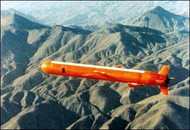
A second offset strategy was conceived in the mid-1970s. American military planners, reeling from the psychological defeat of the Vietnam war, recognised that the Soviet Union had managed to build an equally terrifying nuclear arsenal. They had to find another way to restore credible deterrence in Europe. Daringly, America responded by investing in a family of untried technologies aimed at destroying enemy forces well behind the front line. Precision-guided missiles, the networked battlefield, reconnaissance satellites, the Global Positioning System (GPS) and radar-beating “stealth” aircraft were among the fruits of that research…The second offset strategy,  the so-called “revolution in military affairs” was hammered home in 1991 during the first Gulf war. Iraqi military bunkers were reduced to rubble and Soviet-style armoured formations became sitting ducks. Watchful Chinese strategists, who were as shocked as their Soviet counterparts had been, were determined to learn from it.

The large lead that America enjoyed then has dwindled. Although the Pentagon has greatly refined and improved the technologies that were used in the first Gulf war, these technologies have also proliferated and become far cheaper. Colossal computational power, rapid data processing, sophisticated sensors and bandwidth—some of the components of the second offset—are all now widely available.

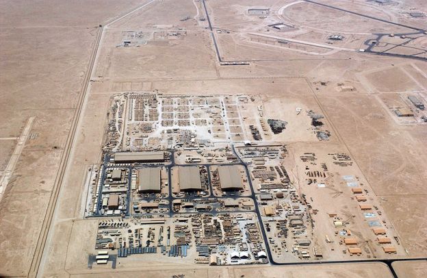
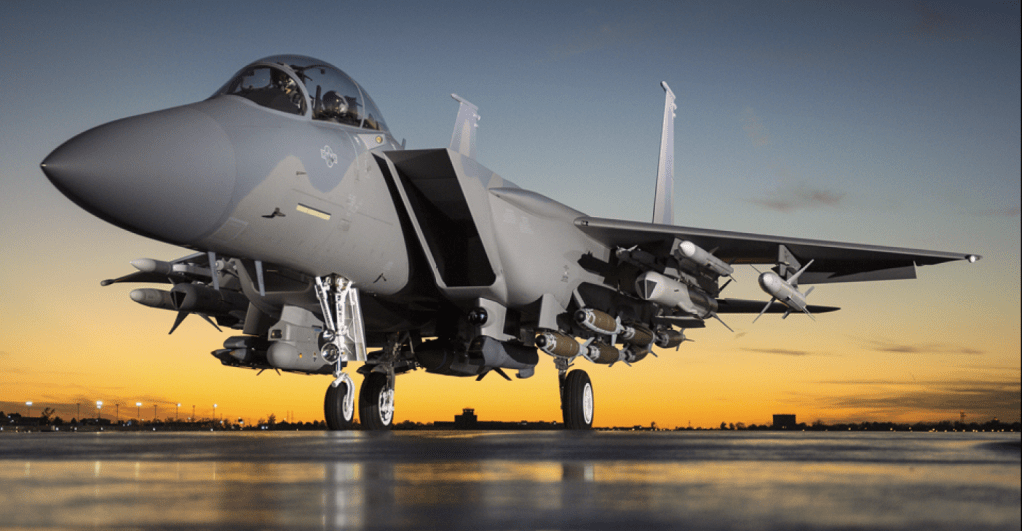
And America has been distracted. During 13 years of counter-insurgency and stabilisation missions in Afghanistan and Iraq, the Pentagon was more focused on churning out mine-resistant armoured cars and surveillance drones than on the kind of game-changing innovation needed to keep well ahead of military competitors. America’s combat aircraft are 28 years old, on average. Only now is the fleet being recapitalised with the expensive and only semi-stealthy F-35 Joint Strike Fighter.  China, in particular, has seized the opportunity to catch up. With a defence budget that tends to grow by more than 10% a year, it has invested in an arsenal of precision short- to medium-range ballistic and cruise missiles, submarines equipped with wake-homing torpedoes and long-range anti-ship missiles, electronic warfare, anti-satellite weapons, modern fighter jets, integrated air defences and sophisticated command, control and communications systems.

The Chinese call their objective “winning a local war in high-tech conditions”. In effect, China aims to make it too dangerous for American aircraft-carriers to operate within the so-called first island chain (thus pushing them out beyond the combat range of their tactical aircraft) and to threaten American bases in Okinawa and South Korea. American strategists call it “anti-access/area denial”, or A2/AD.  The concern for America’s allies in the region is that, as China’s military clout grows, the risks entailed in defending them from bullying or a sudden aggressive act—a grab of disputed islands to claim mineral rights, say, or a threat to Taiwan’s sovereignty—will become greater than an American president could bear. Some countries might then decide to throw in their lot with the regional hegemon.

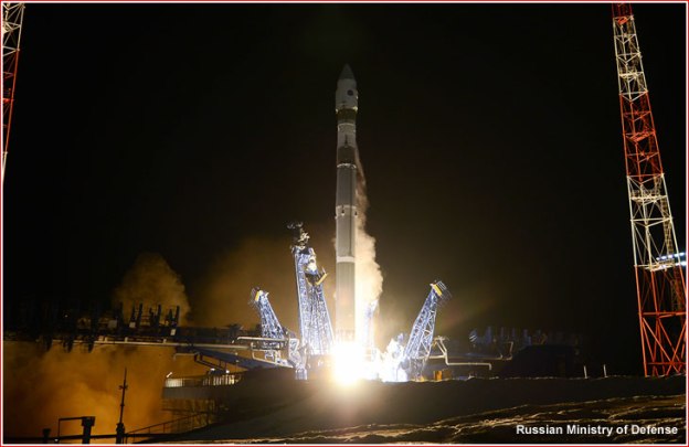
Although China is moving exceptionally quickly, Russia too is modernising its forces after more than a decade of neglect. Increasingly, it can deploy similar systems. Iran and North Korea are building A2/AD capabilities too, albeit on a smaller scale than China. Even non-state actors such as Hizbullah in Lebanon and Islamic State in Syria and Iraq are acquiring some of the capabilities that until recently were the preserve of military powers.

Hence the need to come up with a third offset strategy.….America needs to develop new military technologies that will impose large costs on its adversaries

The programme needs to overcome at least five critical vulnerabilities.

  • The first is that carriers and other surface vessels can now be tracked and hit by missiles at ranges from the enemy’s shore which could prevent the use of their cruise missiles or their tactical aircraft without in-flight refuelling by lumbering tankers that can be picked off by hostile fighters.
  • The second is that defending close-in regional air bases from a surprise attack in the opening stages of a conflict is increasingly hard.
  • Third, aircraft operating at the limits of their combat range would struggle to identify and target mobile missile launchers.
  • Fourth, modern air defences can shoot down non-stealthy aircraft at long distances.
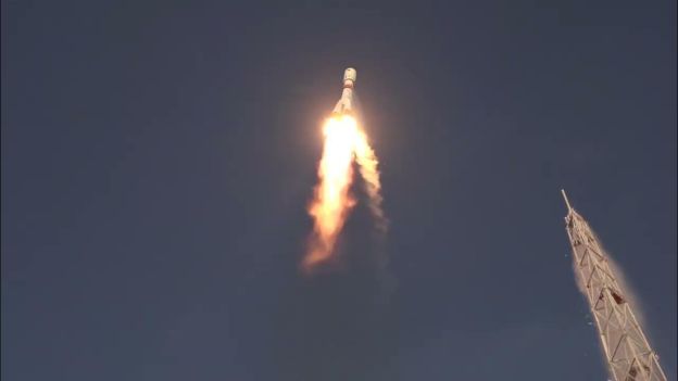
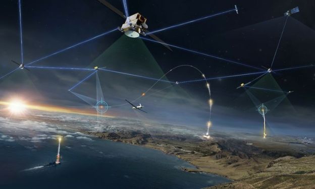
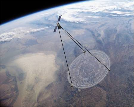
  • Finally, the satellites America requires for surveillance and intelligence are no longer safe from attack.

It is an alarming list. Yet America has considerable advantages…. Those advantages include unmanned systems, stealthy aircraft, undersea warfare and the complex systems engineering that is required to make everything work together.

Over the next decade or so, America will aim to field unmanned combat aircraft that are stealthy enough to penetrate the best air defences and have the range and endurance to pursue mobile targets. Because they have no human pilots, fewer are needed for training. Since they do not need to rest, they can fly more missions back to back. And small, cheaper American drones might be used to swarm enemy air defences.

Drones are widespread these days, but America has nearly two decades of experience operating them. And the new ones will be nothing like the vulnerable Predators and Reapers that have been used to kill terrorists in Yemen and Waziristan. Evolving from prototypes like the navy’s “flying wing” X-47B and the air force’s RQ-180, they will be designed to survive in the most hostile environments. The more autonomous they are, the less they will have to rely on the control systems that enemies will try to disrupt—though autonomy also raises knotty ethical and legal issues.

Some of the same technologies could be introduced to unmanned underwater vehicles. These could be used to clear mines, hunt enemy submarines in shallow waters, for spying and for resupplying manned submarines, for example, with additional missiles. They can stay dormant for long periods before being activated for reconnaissance or strike missions. Big technical challenges will have to be overcome:.. [T]he vehicles will require high-density energy packs and deep undersea communications.

Contracts will be awarded this summer for a long-range strike bomber, the first new bomber since the exotic and expensive B-2 began service two decades ago. The B-3, of which about 100 are likely to be ordered, will also have a stealthy, flying-wing design…

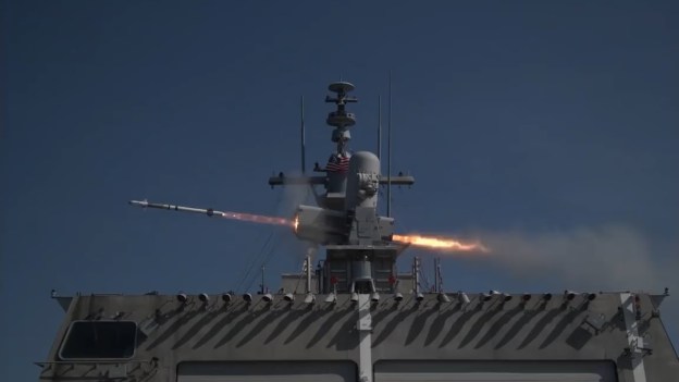
If surface vessels, particularly aircraft-carriers, are to remain relevant, they will need to be able to defend themselves against sustained attack from precision-guided missiles. The navy’s Aegis anti-ballistic missile-defence system is capable but expensive: each one costs $20m or so. If several of them were fired to destroy an incoming Chinese DF-21D anti-ship ballistic missile, the cost for the defenders might be ten times as much as for the attackers.

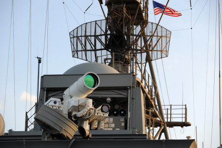
If carriers are to stay in the game, the navy will have to reverse that ratio. Hopes are being placed in two technologies: electromagnetic rail guns, which fire projectiles using electricity instead of chemical propellants at 4,500mph to the edge of space, and so-called directed-energy weapons, most likely powerful lasers. The rail guns are being developed to counter ballistic missile warheads; the lasers could protect against hypersonic cruise missiles. In trials, shots from the lasers cost only a few cents. The navy has told defence contractors that it wants to have operational rail guns within ten years.

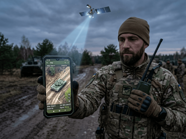
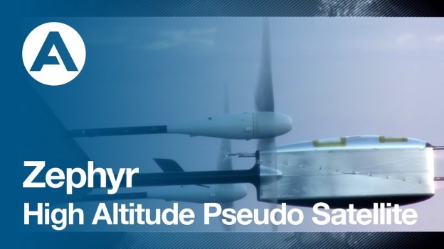
Defending against salvoes of incoming missiles will remain tricky and depend on other technological improvements, such as compact long-range radars that can track multiple targets. Finding ways to protect communications networks, including space-based ones, against attack is another priority. Satellites can be blinded by lasers or disabled by exploding missiles. One option would be to use more robust technologies to transmit data—such as chains of high-altitude, long-endurance drones operating in relays….

As Elbridge Colby of the Centre for a New American Security argues: “The more successful the offset strategy is in extending US conventional advantages, the more attractive US adversaries will find strategies of nuclear escalation.” The enemy always gets a vote.

Weapons Technology: Who’s Afraid of America, Economist, June 13, 2015, at 57.

Catching Illegal Fishers

From INTERPOL: Between 6 and 13 January, 2005 a Royal New Zealand Naval Patrol spotted the vessels – the Yongding, the Kunlun and the Songhua – hauling gill nets laden with toothfish in an area regulated by the Convention on the Conservation of Antarctic Marine Living Resources (CCAMLR) where such fishing methods are prohibited.

——

The Pew Charitable Trusts, an American research group… reckons that around one fish in five sold in restaurants or shops has been caught outside the law. That may amount to 26m tonnes of them every year, worth more than $23 billion. This illegal trade, though not the only cause of overfishing, is an important one…

The new monitoring system has been developed by the Satellite Applications Catapult, a British government-backed innovation centre based at Harwell, near Oxford, in collaboration with Pew. In essence, it is a big-data project, pulling together and cross-checking information on tens of thousands of fishing boats operating around the world. At its heart is what its developers call a virtual watch room, which resembles the control centre for a space mission. A giant video wall displays a map of the world, showing clusters of lighted dots, each representing a fishing boat.

The data used to draw this map come from various sources, the most important of which are ships’ automatic identification systems (AIS). These are like the transponders carried by aircraft. They broadcast a vessel’s identity, position and other information to nearby ships and coastal stations, and also to satellites. An AIS is mandatory for all commercial vessels, fishing boats included, with a gross tonnage of more than 300. Such boats are also required, in many cases, to carry a second device, known as a VMS (vessel monitoring system). This transmits similar data directly to the authorities who control the waters in which the vessel is fishing, and carrying it is a condition of a boat’s licence to fish there. Enforcement of the AIS regime is patchy, and captains do sometimes have what they feel is a legitimate reason for turning it off, in order not to alert other boats in the area to profitable shoals. But the VMS transmits only to officialdom, so there can be no excuse for disabling it. Switching off either system will alert the watch room to potential shenanigans.

The watch room first filters vessels it believes are fishing from others that are not. It does this by looking at, for example, which boats are in areas where fish congregate. It then tracks these boats using a series of algorithms that trigger an alert if, say, a vessel enters a marine conservation area and slows to fishing speed, or goes “dark” by turning off its identification systems. Operators can then zoom in on the vessel and request further information to find out what is going on. Satellites armed with synthetic-aperture radar can detect a vessel’s position regardless of weather conditions. This means that even if a ship has gone dark, its fishing pattern can be logged. Zigzagging, for example, suggests it is long-lining for tuna. When the weather is set fair, this radar information can be supplemented by high-resolution satellite photographs. Such images mean, for instance, that what purports to be a merchant ship can be fingered as a transshipment vessel by watching fishing boats transfer their illicit catch to it.

As powerful as the watch room is, though, its success will depend on governments, fishing authorities and industry adopting the technology and working together, says Commander Tony Long, a 27-year veteran of the Royal Navy who is the director of Pew’s illegal-fishing project. Those authorities need to make sure AIS and VMS systems are not just fitted, but are used correctly and not tampered with. This should get easier as the cost of the technology falls.

Enforcing the use of an identification number that stays with a ship throughout its life, even if it changes hands or country of registration, is also necessary. An exemption for fishing boats ended in 2013, but the numbering is still not universally applied. Signatories to a treaty agreed in 2009, to make ports exert stricter controls on foreign-flagged fishing vessels, also need to act. Fishermen seek out ports with lax regulations to land illegal catches….

The watch room will also allow the effective monitoring of marine reserves around small island states that do not have the resources to do it for themselves. The first test of this approach could be to regulate a reserve of 836,000 square kilometres around the Pitcairn Islands group, a British territory in the middle of the South Pacific with only a few dozen inhabitants.

The watch-room system is, moreover, capable of enlargement as new information sources are developed. One such may be nanosats. These are satellites, a few centimetres across, that can be launched in swarms to increase the number of electronic eyes in the sky while simultaneously reducing costs. Closer to the surface, unmanned drones can do the same.

Combating illegal fishing: Dragnet, Economist, Jan 24, 2015, at 70

Space Conquest: DARPA Phoenix

The traditional process of designing, developing, building and deploying space systems is long and expensive. Satellites today cannot follow the terrestrial paradigm of “assemble, repair, upgrade, reuse,” and must be designed to operate without any upgrades or repairs for their entire lifespan—a methodology that drives size, complexity and ultimately cost. These difficulties apply especially to the increasing number of expensive, mission-critical satellites launched every year into geosynchronous Earth orbit (GEO), approximately 22,000 miles above the Earth. Unlike objects in low Earth orbit (LEO), such as the Hubble Space Telescope, satellites in GEO are essentially unreachable with current technology.

Advanced GEO space robotics: DARPA is developing a variety of robotics technologies to address key on-orbit mission needs, including assembly, repair, asset life extension, refueling, etc., in the harsh environment of geosynchronous orbit. Development activities include the maturation of robotic arms and multiple generic and mission-specific tools. …

Satlets: A new low-cost, modular satellite architecture that can scale almost infinitely. Satlets are small independent modules (roughly 15 pounds/7 kg) that incorporate essential satellite functionality (power supplies, movement controls, sensors, etc.). Satlets share data, power and thermal management capabilities. They also physically aggregate (attach together) in different combinations that would provide capabilities to accomplish a range of diverse space missions with any type, size or shape payload. Because they are modular, they can be produced on an assembly line at low cost and integrated very quickly with different payloads. DARPA is presently focused on validating the technical concept of satlets in LEO.

Payload Orbital Delivery (POD) system: The POD is a standardized mechanism designed to safely carry a wide variety of separable mass elements to orbit—including payloads, satlets and electronics—aboard commercial communications satellites.

Uncontacted Tribes: Amazon

The vast jungles of the Amazon rainforest harbor tribes mostly isolated from the outside world, whose way of life, largely unchanged for millennia, is now increasingly threatened by intrusions from modern civilization.  Now, scientists reveal they can monitor these “uncontacted tribes” using satellites, which would allow safe, inexpensive and noninvasive tracking of these tribes in order to protect them from outside threats.

The investigators focused on indigenous groups concentrated near the headwaters of the Envira River, located at the border of Brazil and Peru. These include the Mashco-Piro, nomadic hunter-gatherers who live in Peru’s densely forested Madre de Dios region, and a number of Pano-speaking farming societies.

The researchers combed through satellite images to look at five isolated villages previously identified via overflights by Brazilian officials. They confirmed these locations and measured the sizes of their villages, houses and gardens. The villages ranged from a small one of about 50 people to a large and growing village of about 300 people. “We can find isolated villages with remote sensing and study them over time,” Walker told Live Science. “We can ask: Are they growing? Do they move?”

Surprisingly, based on the sizes of the houses and villages, the scientists find the population densities of these isolated villages is about 10 times greater, on average, than other villages of indigenous Brazilian peoples….. The researchers now plan to focus on 29 more isolated villages….

Excepts, Charles Q. Choi ,Isolated Amazon Tribes Monitored with Space-Age Technology,LiveScience.com, Nov. 5, 2014

The Space Belongs to Drones

Zephyr– high-altitude “pseudo-satellite” ( HAPS) —  is actually an unmanned, ultra-light, solar-powered, propeller-driven aircraft. But it is designed, just as some satellites are, to hover indefinitely over the same part of the world. With a 23-metre wingspan and a weight of only 50kg, it is fragile and must remain above the ravages of the weather and the jet stream both by day and by night. It therefore flies at an altitude of around 21km (70,000 feet) during daylight hours, and then glides slowly down to around 15km when the sun is unavailable to keep it aloft….

The main uses for satellites are observation and communication. Both are appealing markets for HAPS. Hovering drones could act as relays for telephone calls and internet traffic in places that do not have good enough infrastructure on the ground. And there is never a shortage of customers who would like to snoop on various parts of the Earth’s surface, whether for commercial or military reasons.

By satellite, such snooping is done from an altitude of about 800km. Zephyr flies at one-fortieth of that, so the optics its needs to take pictures are far less demanding. (Just as well, of course, for it is unlikely to be able to carry a huge payload.)

Airbus is not alone in the HAPS game. Google and Facebook are involved as well—and with similar customers in mind—though Google will also be its own customer, since keeping its Google Earth imagery up to date is a demanding task. Paul Brooks, spokesman for Airbus’s HAPS programme, says he does not see these firms as competitors, but rather as collaborators in proving the idea of endurance flight and promoting the changes in regulations needed to permit its safe use. Once this has happened, and the world’s aviation authorities have agreed common operating standards, HAPS should prove a cheap and reliable alternative to blasting things into orbit.

Excerpts, Pseudo-satellites: The west wind blows afresh, Economist, Aug. 30, 2014

Drone Missile Defense

The best time to shoot down a hostile missile is straight after take-off. During this initial “boost phase” it moves more slowly, is easier to spot (because its exhaust plumes are so hot) and presents a bigger target (having not yet ditched its first-stage fuel tanks). A bonus is that the debris may come crashing down on the country that launched it—your enemy—rather than you. But the main advantage of “boost-phase missile defence” is that your military does not have to deal with decoys.   A missile that has breached the atmosphere and begun its midcourse glide can throw off lots of decoys. In the vacuum of space, tinfoil balloons, or clouds of aluminium strips known as chaff, will keep pace with the missile that released them. Not even the American military can distinguish sophisticated decoys from a warhead (though it might manage with crude ones designed by Iran or North Korea, say).

The downside, though, [of a boost-phase missile defense] is that requires speed. Interceptors (anti-missile missiles) fired from sea or land will probably be too late. Ronald Reagan’s proposed solution was “Star Wars”: armed satellites orbiting above hostile nations’ launchpads. It cost a packet, didn’t work and was scrapped in the 1990s. But some experts say the moment has arrived for a sequel: high-altitude drones. North Korea’s arsenal of ballistic missiles could probably be countered if as few as three drones were suitably stationed at all times, says Dale Tietz, a former Star Wars analyst. An American Global Hawk drone, which can fly uninterrupted for 30 hours, held 18km above nearby international waters could probably carry several interceptors fast enough to shoot down missiles heading north towards America, he says. It could be alerted to launches by infrared-sensing satellites already in orbit.

Protecting Israel and Europe from Iranian missiles would be harder. Iran is bigger than North Korea, so interceptors would need to be faster (and therefore larger) to reach deep inside its territory. The Pentagon has started to research drone-missile defence, but should be spending more, says David Trachtenberg, a former deputy assistant defence secretary, because the payoff could be “tremendous”. Such an approach would fail against really big countries like China and Russia (which in any case can launch missiles from undetectable submarines). In one sense this is a plus: what does not work against a country cannot antagonise it. Congress would oppose any system that would spur an arms race, says Kingston Reif of the Centre for Arms Control and Non-Proliferation, a think-tank.

Supporters of drone-missile defence note that America’s existing system, which aims to shoot down hostile intercontinental ballistic missiles with interceptors fired from Alaska and California, has failed every big test since 2008. Sceptics retort that although American drones are stealthy—dozens went undetected over Pakistan during the hunt for Osama bin Laden—better radar and anti-aircraft batteries could render them vulnerable or force them to patrol too far from their intended targets. If North Korea were to develop faster missiles this problem would be compounded, says David Montague, a former head of the missiles division at Lockheed (now Lockheed Martin), a defence firm.

Two years ago a report by the National Research Council advised the Pentagon to give up the attempt to design a boost-phase missile system. The challenge of keeping interceptors close enough to enemy launchpads is “pretty much insurmountable”, says Mr Montague, who was one of the authors. Which camp will prevail is not yet clear. But if the current system fails its next test, probably this summer, the debate will heat up further.

Missile defence: Star Wars 2: attack of the drones, Economist,  May 17, 2014, at 29

China’s Anti-Satellite Capabilities

Chinese media claimed on May 3, 2014 without reference to specific sources…that China has destroyed the control chip of a Japanese spy satellite with a secret weapon.  The attack reportedly happened when the satellite was tracking a Chinese J-20 stealth fighter jet in northwestern China. The satellite is the third Japanese spy satellite launched from Kagoshima, Japan….Chinese media goes on to claim that US analysts believe that China used the electromagnetic pulse weapon Poacher One in the attack. That is China’s top secret military research and development project.

The PLA’s electromagnetic weapon Poacher One is able to transmit an electromagnetic pulse of several megawatt continuously for one minute to destroy all military and civil electronic information and communications systems operating within a few kilometres. It can also destroy an enemy’s internal chips.  The report claims further that US military previously revealed that the PLA had sent a satellite near a US spy satellite and blinded it with spray of coating on its camera. PLA has lots of means to attack and interfere with satellites. US military is concerned that neutralisation of US satellites by PLA’s space force will be its nightmare in war.  However, the development of anti-satellite technology does not stop there. It may be the basis for the technology to intercept an ICBM. That will be a much greater worry for the US military.

Excerpt from CHANKAIYEE2 , China claims successful attack on Japanese military satellite; destroyed control chip with “secret weapon”, China Daily,  MAY 3, 2014

Nowhere to Hide: Panopticon Satellites

From the DARPA website: DARPA’s Membrane Optical Imager for Real-Time Exploitation (MOIRE) program aims to create technologies that would enable future high-resolution orbital telescopes to provide real-time video and images of the Earth from Geosynchronous Earth Orbit (GEO)—roughly 22,000 miles above the planet’s surface. Size and cost constraints have so far prevented placing large-scale imaging satellites in GEO, so MOIRE is developing technologies that would make orbital telescopes much lighter, more transportable and more cost-effective.

Currently in its second and final phase, the program recently successfully demonstrated a ground-based prototype that incorporated several critical technologies, including new lightweight polymer membrane optics to replace glass mirrors. Membrane optics traditionally have been too inefficient to use in telescope optics. MOIRE has achieved a technological first for membrane optics by nearly doubling their efficiency, from 30 percent to 55 percent. The improved efficiency enabled MOIRE to take the first images ever with membrane optics.

While the membrane is less efficient than glass, which is nearly 90 percent efficient, its much lighter weight enables creating larger lenses that more than make up the difference. The membrane is also substantially lighter than glass. Based on the performance of the prototype, a new system incorporating MOIRE optics would come in at roughly one-seventh the weight of a traditional system of the same resolution and mass. As a proof of concept, the MOIRE prototype validates membrane optics as a viable technology for orbital telescopes.

“Membrane optics could enable us to fit much larger, higher-resolution telescopes in smaller and lighter packages,” said Lt. Col. Larry Gunn, DARPA program manager. “In that respect, we’re ‘breaking the glass ceiling’ that traditional materials impose on optics design. We’re hoping our research could also help greatly reduce overall costs and enable more timely deployment using smaller, less expensive launch vehicles.”

Instead of reflecting light with mirrors or refracting it with lenses, MOIRE’s membrane optics diffract light. Roughly the thickness of household plastic wrap, each membrane serves as a Fresnel lens—it is etched with circular concentric grooves like microscopically thin tree rings, with the grooves hundreds of microns across at the center down to only 4 microns at the outside edge. The diffractive pattern focuses light on a sensor that the satellite translates into an image.

MOIRE technology houses the membranes in thin metal “petals” that would launch in a tightly packed configuration roughly 20 feet in diameter. Upon reaching its destination orbit, a satellite would then unfold the petals to create the full-size multi-lens optics. The envisioned diameter of 20 meters (about 68 feet) would be the largest telescope optics ever made and dwarf the glass mirrors contained in the world’s most famous telescopes.

From GEO, it is believed, a satellite using MOIRE optics could see approximately 40 percent of the earth’s surface at once. The satellite would be able to focus on a 10 km-by-10 km area at 1-meter resolution, and provide real-time video at 1 frame per second.

Ball Aerospace & Technologies Corp. is the prime contractor for the MOIRE program.